
By Ben Marean
1) Get a good map. I would suggest the Plumas National Forest map. The California Gazetteer is inadequate and doesn't even show the road that goes to the take-out.
2) Get an early start. The weekend I was there I heard stories of four separate groups having to hike out in the dark after running out of day light in the previous two weeks.
3) Have at least one person in your group willing to probe IV+ drops that are difficult to boat scout. Or better yet, bring someone that knows the run. The drops are so numerous, that there is not time to scout them all. This is how people get stuck in the dark before getting to take-out.
By sheer luck Dave, Kevin, and I managed to follow all three of these recommendations. We got to the very small town of La Porte about 7:00 the night before our float to make some phone calls (no cell phone service out here). In our haste we had neglected to stop at any ranger station to get a map, and of course everything was closed.
Somehow we got lucky and the guy that owns the local sportsmen/snowmobile shop just happen to be there. He opened up the shop for us and sold us the much needed Plumas National Forest map. With the good map and some OK directions we were able to find the take-out in the dark.
Camped at the take-out we met Darin from Shasta. He had been camped there all week running the South Fork every day. Now we had someone that knew the run. After hearing multiple stories that night about people hiking out in the dark we opted for the early start.
It was a little hard to get out of the warm sleeping bag the next morning, but we made the 45 minute drive back to the Little Grass Valley Dam and had the boats unloaded by 9:00 a.m.
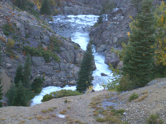
The run starts with a ˝ mile class V gorge that has a 30' waterfall in the middle. Rumor is that there are rocks in the landing. I didn't look that close, because I knew I would be walking it. If you are running the gorge, carry your boat down the right side of the dam. If you want to start below the first gorge, going down the left side of the dam looked like the easier hike.
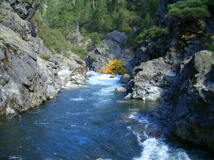
Looking down into the first gorge form the top of Little Grass Valley Dam.
Photo by Ben Marean.
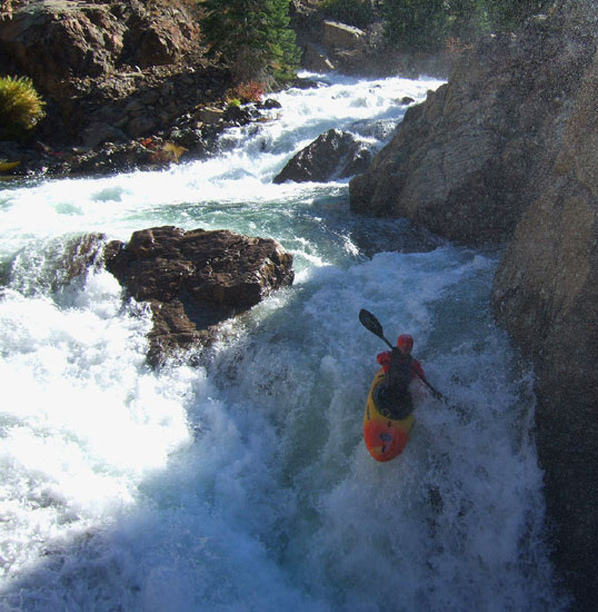
All week the flow had been 350 cfs, but the dam operator had already increased to flow to 400 cfs that morning and it was going to be 425 cfs in the next hour. Overall, the people I talked to seemed to think this was the optimum flow. I didn't know what to expect with the increased flow, but I was a little nervous when I got down to river level. The first rapid, which is 20 feet from the put-in, is a clean 10' drop. Clean if you are on the left side that is, it looked like a bumpy ride down the right side. The interesting part is put-in is on the right side. So much for having a little time to warm up the shoulders, before making a power ferry across the river..
The author running the first drop. In the upper left corner the put-in eddy is just visible. In the lower left, some of the rocks that you would be bouncing off of if you don't make the ferry are visible through the water.
Photo by Kevin Smith.
Darin and I went first while Dave ran safety and Kevin took photos. Darin made the ferry and disappeared over the horizon line. Dave gave me the OK signal and I was off. I thankfully made the ferry to river left and paddled over the lip. Wow, what a fun drop with a soft landing. Then Kevin came down with a clean run. Dave had a more interesting run however. He made the ferry, but when he tried to paddle up the cushion on the left wall at the lip to get a good boof the nose of his boat perled into the base of the cushion and he penciled straight into the meat of the drop.
Another boater got this on video and we watched it at the end of the day. Dave was under, still in his boat for almost a 5 count, but when it was happing in front of me it seemed much longer. It was to the point where I thought he must have popped up behind the curtain and I just couldn't see him and I was planning my rescue strategy. It didn't look like it could have held him under for so long. Finally Dave and his boat came back to the surface and we were on our way again.
I didn't want to take any chances with getting swept over the 30 footer. It has a long class V above it and with the higher flow only a small eddy between them so I started my portage early. The second drop below the 30 footer looked pretty sticky at the bottom so I thought while I'm out of my boat I might as well just keep walking. Darin opted to run it and made it look easy. Two more rapids and we were out of the first gorge.
Darin about to sub-out in the first gorge.
Photo by Kevin Smith
After that, things let up for a mile or two with fun continues class III. If you hike the first gorge this section provides a nice warm up. It doesn't take long to get through this part and soon the drops are steep enough you can't see the bottom of them. The average gradient for the run is 154 feet/mile, but a good chunk of it in the middle is over 200 feet/mile. This is when it is key to have someone willing to probe. Darin was that person in our group since he had the run memories. We were making good time down river since we didn't need to scout, Darin just gave us verbal instructions on the bigger ones.
In one of the mellower sections, I was last and was about to follow Dave over a small ledge when his boat did a tail-stand at the bottom followed by several other rodeo moves. Dave is a very solid boater and he was getting worked in this hole so I thought I better stop and take a look. By the time I got out of my boat, Dave was out of his too. There wasn't much I could do for him, but Kevin and Darin were down stream to pick up the pieces.
If I had just followed Dave and rammed into him, assuming I didn't hit him in the face with my boat, and knocked him out of the hole, that would have been the best thing that happened to him all day. But what actually happened is he went into a tail stand, his face was looking up into the spill over the ledge. This filled his nose, sinuses, and mouth with water and he used most of his air blowing that water back out. Hoping to remedy the problem he swam so he could get out of the hole and get some air. This worked for his boat, but he stayed in the same spot. Unlike most swims in holes this one wasn't violent at all; he was just suspended below the surface, unable to swim to the top and not getting flushed out the bottom.
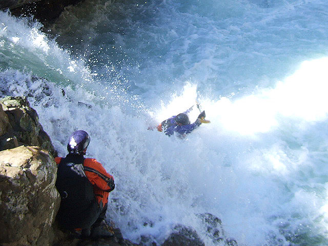
Dave has told me some scary stories about bad swims he has had that make me afraid to go kayaking and he said this was the worst swim he has had. It wasn't till he thought "this is what it is like to drown" that he flushed out.
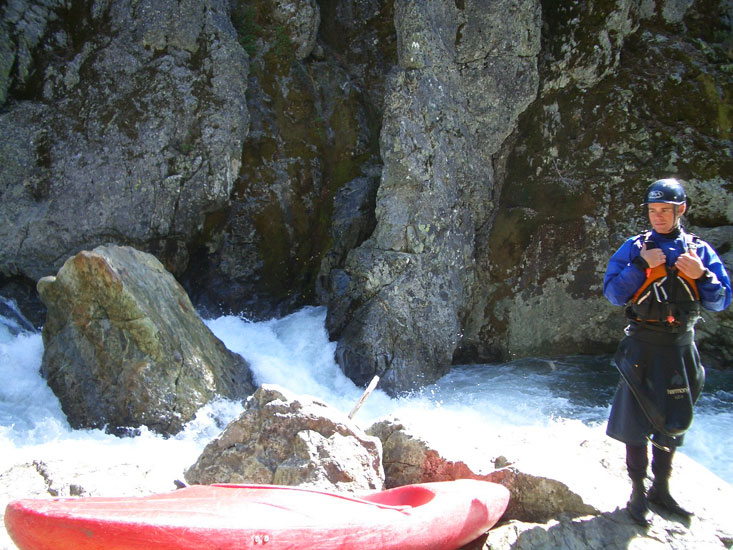
Dave catching his breath after a bad swim, but happy to be alive.
Photo by Ben Marean
This put everyone on edge so I was relieved when we were through the steeps of the gorges and found a sunny rock to have lunch on.
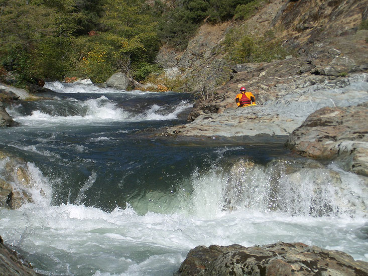
View of the river from our lunch spot. A relative calm spot in one of the many mini gorges.
Photo by Ben Marean
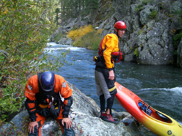
With the exception of the first gorge, some consider this to be a class IV run. I agree that the individual rapids are class IV, but put them all together and it is a class V run. There are a couple of surprises to be aware of too like a steep junky rapid in the middle of the run that we all portaged.
Darin standing near the bottom of a junky rapid that we portaged.
Photo by Ben Marean
As the day went on I was wishing I had done more paddling recently so I would have been in better shape. When we got to a part that has a series of slides I remember thinking that "If I flip I'm going to swim.." I was working so hard to punch through the holes at the bottom of each slide that I was hyperventilating and I realized that if I had to interrupt my breathing to roll it would really suck, but I was too tired to catch an eddy..
Near the end of the class IV rapids is a mandatory portage around a narrow twenty foot slot drop that lands on a ledge. The clues that you are near the portage are three ledge drops in a row, and then the river narrows and disappears.
The portage is on the right.
Kevin setting up for the last of the three ledge drops immediately before the portage.
Photo by Ben Marean
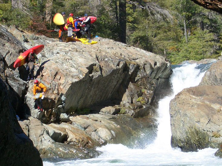
Rush hour at the mandatory portage. I think every one that was on the river that day got to the portage at the same time.
Photo by Ben Marean
While drifting through a mellow, but fast moving section of river, Kevin was wiping water out of his face as we all squinted trying to see into the late afternoon sun. He hit a rock, spun sideways, and firmly broached in the swift current. His boat was completely underwater, but his head was above water. After unsuccessful attempts to push himself off of the rock, I was concerned he might have difficulty getting out of the boat safely. By the time I got out of my boat and hiked back up with my rescue kit Kevin had safely exited his boat and had clipped a line on it to free it from the rock. We didn't have to use any pulleys, but it took some serious pulling by the two of us to get the boat off the rock.
With some new scratches and a noticeable dent in Kevin's boat we continued on a little more wary of even the little rapids.
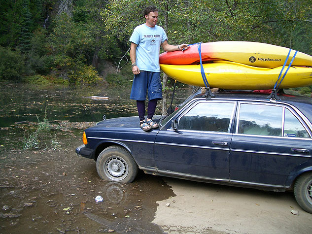
The take-out is in the slack water caused by a diversionary dam. As we loaded boats on cars it became clear that the water level of this mini reservoir was rising rapidly with the increased flows, and we should be moving on before the parking lot was underwater!
Darin getting the boats on his car just in time to avoid being flooded out by the rising reservoir.
Photo by Ben Marean
There are a million little logging roads up here, but if you have the Plumas National Forest map you are trying to get to the little un-named reservoir 8 miles down stream from the Little Grass Valley Reservoir.