Nature: Very continuous. Long, steep rapids in a deep, roadless canyon.
Gradient: 207 fpm
Length: 3.4 miles on the river, 0.3 miles on the reservoir
Season: Primarily rain, but can run during big snowmelt years

Copyright © 2003, 2008, Oregon Kayaking. No part of this page may be reproduced, linked, or copied without the express written permission of the Oregon Kayaking Webmaster.
The North Fork of the Clackamas is my favorite run in the Clackamas Drainage; steep and creeky with fun ledges, impressive boulder gardens, and a big, burly waterfall. Even though this run doesn't rate a class V except at high water, you'd better be on your game when you run this one; there are some pretty good boaters on the North Fork Clack Swim team.
A piece of advice: Stay away from the North Fork at low water; the rapids are very tight and rocky even at high flows; at low water they are pure misery. I have included flow data at the end of this report to ensure you get it right when you go up there.
It is easy to get lost trying to find the road to hike down to the creek; look for a tree with the number '3' painted on it three miles from the main road. This marks the side road you use to hike into the North Fork. From here it is about a quarter mile downhill hike to the creek.
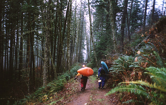
The stresses of daily living slowly melt away as you hike down into the North Fork river canyon; the woods close in around you and the river starts to draw you in as the distant roar gradually increases in volume..
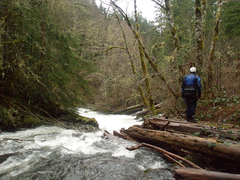
Dan Coyle and Pete Giordano hiking in on the North Fork Clack
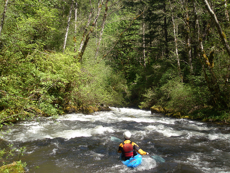
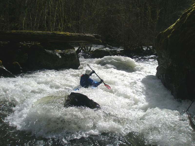
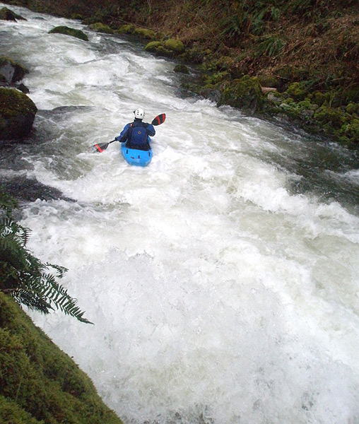
Below the put in the river eases you into things; the rapids start out splashy and playful, with a few smaller drops and some eddies for warm-up.
Start your engines: Josh Knapp heads into the first section of steeps on the North Fork Clackamas.
There are a few steeper drops at the beginning section, then you start running a series of drops which signal what lies downstream..
Pete enters a typical North Fork rapid on the upper section. Very fun stuff!
Soon enough the gradient picks up and the blind corners start to appear as the North Fork gradually reveals its true nature. The first big drop ( pictured below, the ledge is barely visible in the photo below ) is very difficult to scout. You can get out above it on a small island and peer downstream.
The lead-in is straightforward, then you have to get left and boof over a big ledge hole on the next corner. Below the ledge the river rips downstream, catch one of the eddies on the right against the wall and regroup.
Pete checks out the lead-in to the first big drop. This one continues around the corner with a ledge just out of sight. Boof left.
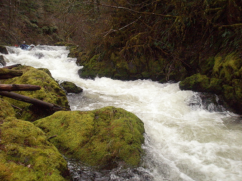
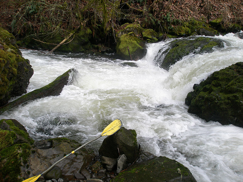
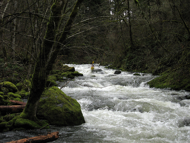
Soon the river starts to narrow as you approach the gorge section. The gorge has fast and continuous rapids leading to a short ledge, boof left or center. This ledge used to have a log in it but it is gone now. At higher flows the gorge section is superb, with tons of big soft holes forming a nearly non-stop hundred yard long gauntlet.. This is probably one of my favorite sections of whitewater anywhere when the water is cranking through there.
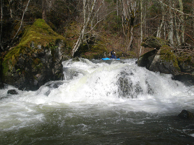
Just downstream of the gorge is the first big falls, which is a mandatory portage. Be on the lookout for some ribbon hanging from the tree limbs on the left, and get out of the river immediately to hike up the faint trail on the left. There is a ten-foot ledge ( known as "Speed Bump" ) that is tempting to run just above the big falls, but don't do it! We ran this drop the first time down, and the portage was much more difficult! If you are looking for a big drop, wait until after the portage and you'll get one..
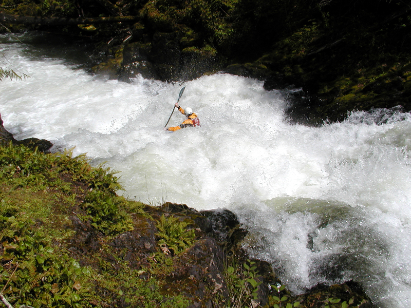
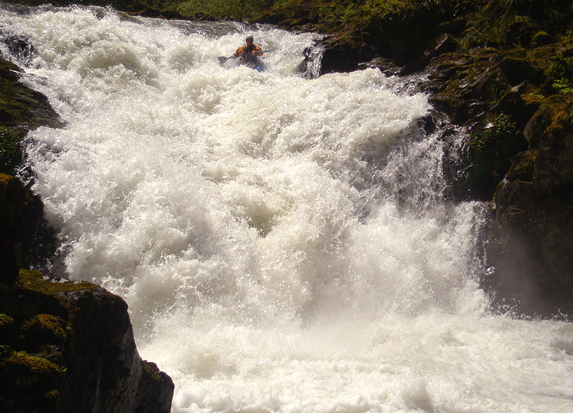
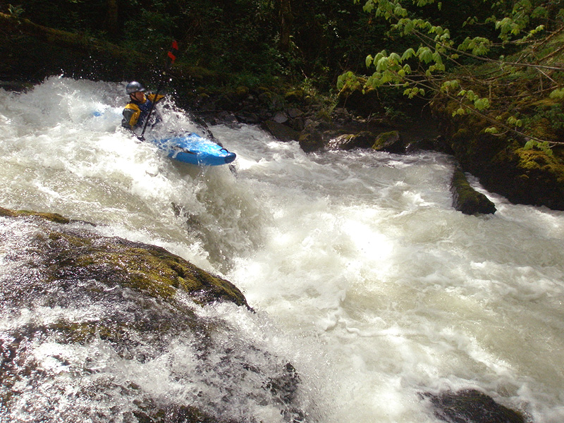
Immediately downstream from the forty five foot falls is another, more runnable class five waterfall ( Named 'Stairway to Heaven' by the late Bill Bowey. ). Stairway is often run, just boof left at the top and line up for the big hole at the bottom. It looks bad but you have so much speed you go right through it..
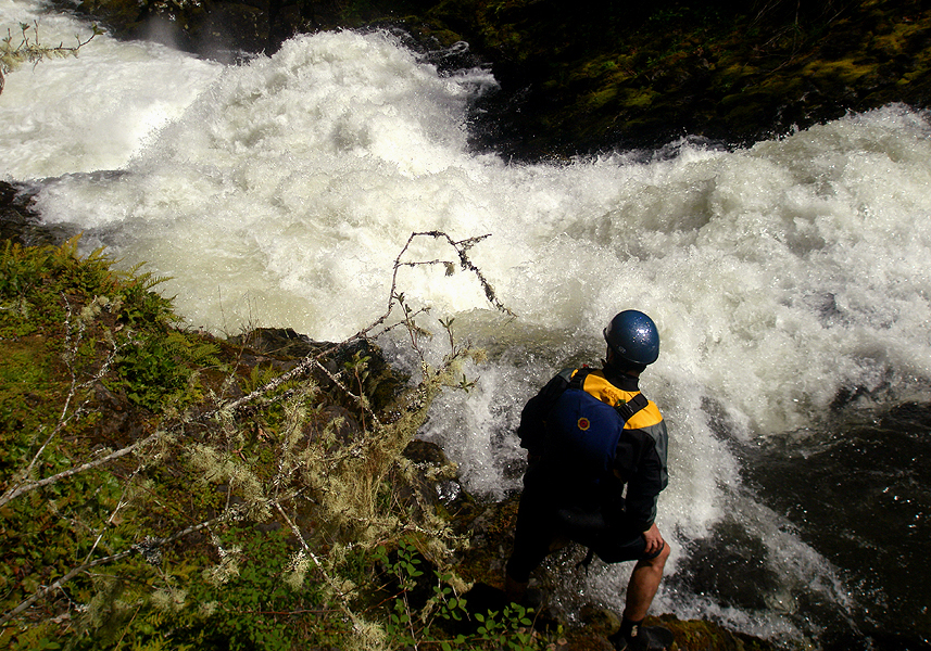
Pete Giordano scouts stairway to heaven.. Josh probed it up a minute later, photos below.
Josh Knapp, a few minutes later..
Photo by Pete Giordano
And, Josh, from the front..
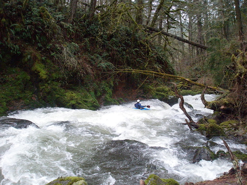
Below Stairway the North Fork starts ripping down through some sweet non-stop rapids; the eddies are small and the lines are tight so hold on for one heck of a ride when the creek is brown and the water is pushing!
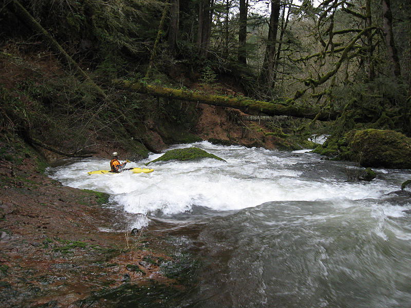
The first rapid that should be scouted by first-timers is below Stairway is called "Pile Driver". Here the river splits around an island and most of the flow goes right, and crashes into a large midstream boulder that is hard to avoid. Try to go right of the boulder if you can, melting through a deep slot into the pool below. Pile Driver has some small ledges preceding it, and is on a blind left corner.
Pete makes the move at Pile Driver.
Pile Driver, from below. This was Pete's second lap..
Be alert on the lower mile; even though it is a lot of fun it is difficult to stop and there are logs in the river. Below one double log portage is a drop known as 'Storm Drain'. Be careful on this one; the hole packs a punch and it is very difficult to scout.
The first time I did the North Fork we all ran Storm Drain without scouting, and luckily there wasn't any wood in it. This was not a good idea. Storm drain tends to collect wood, so always scout it on the left. We learned this the hard way when Pete ran it blind a couple years ago and there was a log wedged in the drop. He tangled it up with the log and lost his paddle, so we always scout this one now. It should be noted that the scouting eddies above Storm Drain are very small and it is very, very easy to get blown into this drop.
Storm Drain. The log and undercut boulder on the left below the hole are potential problem areas.
We didn't used to scout this one, but we do now ever since Pete tangled with a surprise log in this drop and lost his paddle.
Pete runs storm drain.
You have to boof with right angle here or you get stuffed under the log.
Below Storm Drain are some really fun rapids! Pete enjoying some North Fork goodness.
The author boofs a drop downstream..
Photo by Pete Giordano
Below Storm Drain the rapids are fast and furious all the way down to 'Double Blind Date', a blind, twisty drop that should be scouted for wood on the right. Once past the first drop the river roars over a steep, blind boulder garden, we generally go left on the bottom drop. When you scout the first time down, note the boulder sieve on the outside right corner, and the logs extending into the current on both side of the river just downstream.
Pete enters Double Blind Date. This rapid continues for about fifty yards below this entrance drop.
Always scout this one on the right to make sure no wood is waiting around the corner.
The author lines up on the steep jumble of boulders just below the entrance to Double Blind Date.
Below Blind Double Date the gradient cools off but there are still a few small drops. There used to be a number of log portages on this lower section but there aren't any now. When you reach the logjam at the end, eddy out just above it and look for a small channel on the left side of the jam. You can sneak past the wood on this side without getting out of your boat..
Below the log portages is a quarter mile paddle to the take-out..
Old School on the North Fork: The crew on a North Fork Clackamas trip in 2003. Dan Coyle, Gabe Flock and Pete Giordano.
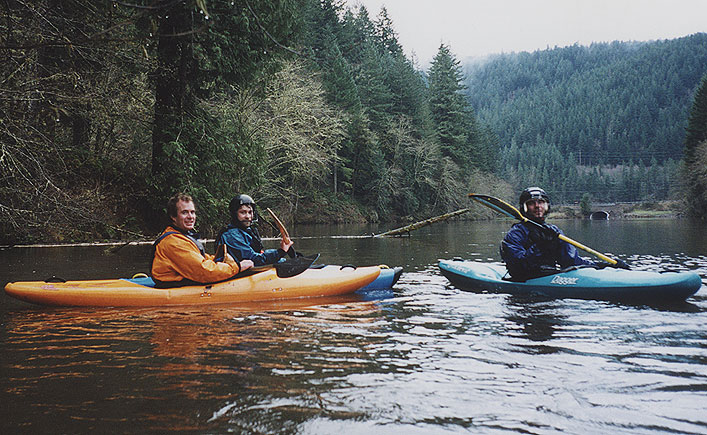
Photo taken by the author during the short paddle out on the North Fork inlet.

To guesstimate flows, calculate the difference between the Clackamas at Three Lynx and the Clackamas at Estacada. You want at least a 2,000 cfs difference between the two gauges after or during a big rain storm. The North Fork runs off fast, so you have to catch it either during or within a day or two of a big storm.
The other key indicator to look for is the outflow 'pushing' out into the main reservoir from the North Fork Reservior. You should see muddier North Fork flows extending out into the main reservoir from the North Fork reservoir as you drive by on Hwy 224, especially after a big rain. If you don't see this discoloration in the main reservoir, the North Fork may not be running.
The North Fork also has snowmelt events during big snow years. If you get a big spike on the Clackamas due to snowmelt, the North Fork often runs ( the Stairway shots of Josh on this trip report were taken in May 2008 when the Clackamas spiked to 8,500 cfs due to snowmelt after a couple of very hot days ).
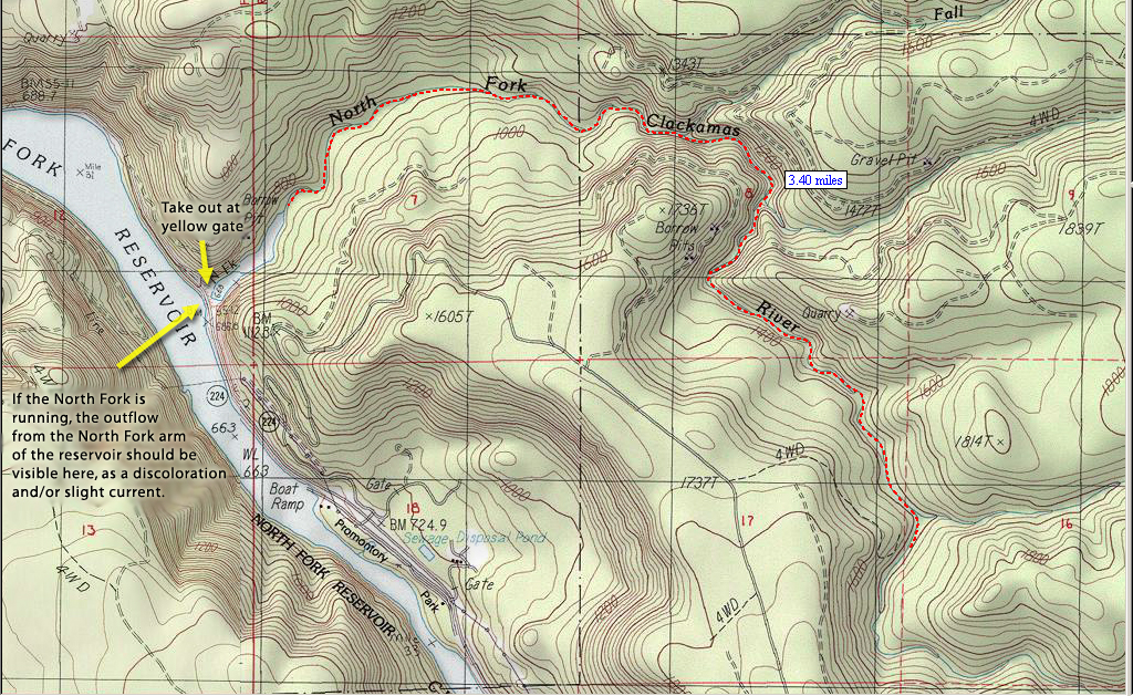
If you want to remove any guesswork from the equation, park at the take out on North Fork reservoir ( at the yellow gate marking the day use area for the North Fork Reservoir ) and jog up the trail on the parking lot side of the reservoir for a quarter of a mile until you get to the river. You can tell you are in the right spot when the trail starts going uphill and you hear the river on your right. Look through the trees and you should be able to see the river flowing over a gravel bar. This gravel bar should be runnable. If it looks like you would grind to a halt on it, go elsewhere. If there is enough water to boat over it with only a few bumps, you are good to go. Do not run the North Fork at low water. You will regret it if you do and your boat may not survive the experience!
To reach the North Fork, turn left off of 224 across the highway from Promitory Park and go uphill for a mile or so until the road turns to gravel. Drive a total of 3.3 miles, or until you see a tree with a large orange '3' painted on it on the left hand side. This marks the road you use to hike down into the canyon. It is currently blocked with some large stumps to keep the off-roaders out of the river drainage.
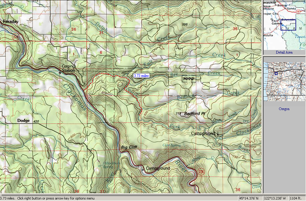
A detail map of the North Fork.
A zoomed-out map of the North Fork. 3.73 miles is the total miles paddled, including river and reservoir.