
This three mile section of the North Fork of the Rogue may be more trouble than it's worth. If you aren't a local, finding the put in and take out can be a real problem... The first time we attempted this run we couldn't find the put-in as the guidebook description is a little vague. Nevertheless, once we finally got on the river (a year later) we had a great time!
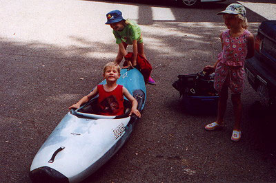
Corrupting the next generation at the put in for the North Fork.
The incredibly steep section immediately above the regular put in at Mill Creek Falls is V+ to VI and has intrigued me ever since I first saw it. I refer to this section as 'The Crucible' while John refers to it hatefully as 'a good place to die' after he ended up in a pothole when we ran it.
The Crucible is quite dangerous but also spectacularly steep and challenging! We have run much of this section but the day we did it the levels were pretty psycho. The river was rising and falling rapidly as the dam upstream released water without rhyme or reason. We would run a rapid, then the water would drop six inches and we would have barely enough to paddle in. It was a crazy and not a little frustrating considering how far we had driven.
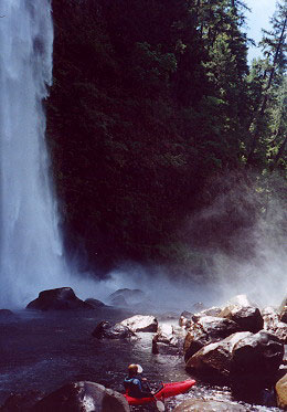
Anyway, we finally got to the Mill Creek Falls, and it was spectacular. This is the regular put in if you don't want to tackle the upper section, and there is no warm up! Here Mill Creek drops 170 feet directly into the river at the lip of a deceptively dangerous rapid. This first drop was a little bit sketchy because the current divides at the base of the falls with the left side disappearing into a killer dead-end siphon and the right side bouncing down through some boulders. John was a still a little spooked after his pothole experience earlier in the day so he portaged this one. I ran the drop and it was wild- I tried to skirt the base of the falls but it was all I could do to stay upright in the howling winds and stinging spray. I emerged from the maelstrom trying to blink the water out of my eyes and I ran the drop without problems. Nevertheless, the force of the falls definitely took me by surprise so be careful if you run this one!
The rapid mentioned above starts just on the other side of the boulders visible through the spray in the photo below.
Downstream from here the gradient holds steady at 180 fpm which makes for an exciting ride through some steep, high quality boulder gardens. There is a ledgy drop just downstream from the falls that has a tricky midstream rock in it so stay alert when you run that one.
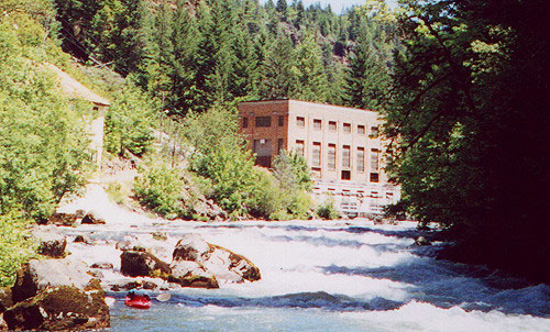
Below the ledge we were thrilled to find aquamarine water and great rapids. I think the water coloring comes from Mill Creek, and it is really amazing. This section was like an easier version of the Little White Salmon, with great boulder gardens in a beautiful, deep canyon. This part of the run was a lot of fun but after a mile or so the gradient tapered off and the river mellowed to class III. Soon we got to the powerhouse and the water added here increased the flow by a third and gave the river more of a big water feel.
John below the powerhouse rapids.
Eventually we we reached Lost Creek Lake and I played as long as I could
in the great hole at the confluence because I knew we
were in for a devilishly hot take out.
The plan was for me to hike up to the road and ride my bike back up to the put in and then pick up John, who agreed to tow my boat a couple of miles across the reservoir... What a guy! Anyway, I got down to the take out pretty quickly and got quite a laugh watching John struggle slowly across the lake. The poor guy was trying his best to tow my Gradient but it has so much rocker it turned sideways every ten feet. I could tell he was getting frustrated and the headwind probably didn't help!
John (in the box) paddles across the endless flatwater to the take out.
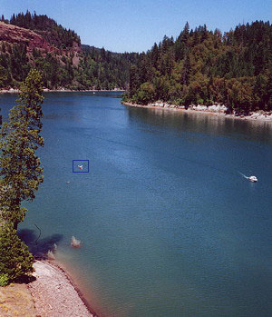
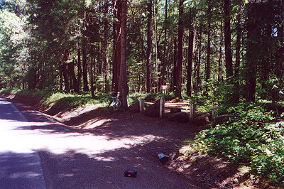
Access, Flows, etc: This section runs all year round but access is tricky. For the take out you have a couple of bad options: Paddle a couple of miles of flatwater or carry your boats up a very steep, rocky path to the road. Follow the directions in Soggy Sneakers and look for the spot pictured below. There is no sign or anything so it's easy to miss. Park here and hike down to the lake so you can find the take out as you pass by- the walk back up will probably convince you that a going across the lake is the better option, especially in the summer.
This is the path/old road leading down to the lake and is the takeout
described in Soggy Sneakers. Hopefully
this picture will save you some frustration! (It's about a quarter of a mile down to the lake and is very steep!)
The put in is also a bit tricky. Park at the "Avenue of Giant Boulders" Tourist park and hike down the trail, staying right if you don't want to run the Crucible. (Which is what the park service calls the 'Avenue of Giant Boulders') Keep looking over the edge of the cliff until you come to a mountain goat trail that drops a hundred feet down into the gorge to Mill Creek Falls. You will need a long rope to lower your boats down. I have never put in here and but it looks pretty dangerous to me.
Flows: We ran this section when Pat Welch's River Bridge gauge read about 1000 cfs. However, this only provides a rough estimate as this run is controlled by a reservoir upstream that doesn't have a gauge. Nevertheless, this section runs year round.
More on the Crucible: This section is super steep (maybe 500 fpm) and is filled with huge siphons, sieves, and potholes. Nevertheless, if there are adequate flows this section is pretty phenomenal.