The Black Rock Fork
By Jason Rackley
The headwaters of the South Fork Umpqua, first known descent.
Brad Coleman, EJ Etherington, Gabe Flock, Jason Rackley,
James Bagley Jr, Megi Morishita, Ryan Scott
Torture Factor: Medium
|
The Black Rock Fork By Jason Rackley The headwaters of the South Fork Umpqua, first known descent.
Brad Coleman, EJ Etherington, Gabe Flock, Jason Rackley, Torture Factor: Medium |
|

The email was from Chad Belville, who had discovered Kenobi Gorge for us in 2006. Now Chad had moved south, deep into Oregon's Cascade Mountains. Apparently he was living five miles south of the the middle of nowhere .."I'm making my own electricity!!".. and was exploring the headwaters of the rarely-paddled South Fork of the Umpqua River.
".. Jason: I talked to Pete about this last winter but he's laid up with a busted knee and this s--t needs to get run. Black Rock Fork. This one is GOOD. It's a river not a creek. The gradient is not high, but, pool......DROP.."
I broke out the topo map and plotted it out. Way out in the middle of nowhere. Medium gradient, so the geology would be critical. Then Chad sent me photos and all I saw was bedrock. Lots of bedrock. And waterfalls.. and ledges. "Ohhhh hell yeah!!" I thought when I saw the photos.. "It's ON!!"
I sent out an email to a few of the crew. "Got an email from Chad, the guy who found Kenobi. He's found something down in Southern Oregon. I think we should check it out this weekend, this guy is like some kind of frickin' genius when it comes to finding new stuff to run.."
After we firmed up the date and time, I expanded the invite and looped in a total of seven paddlers, a very strong team. Ryan Scott rallied out of Hood River, Brad Coleman from Vancouver, James Bagley Jr and EJ Etherington from Corvallis, Megi Morishita and Gabe Flock from Eugene. It was most of the original Kenobi crew all over again. With a few notable exceptions..
I checked my voicemail and had one from Mike Long. He sounded mildly traumatized. "Jaaaason.. How can you plan an exploratory mission this weekend.. I'm moving into my new house, I gotta go get the U-Haul right now. I tried to convince my Fiance that I needed to go paddling instead of helping with the move, but she was having none of it."
I replied by email: "Man, if you would've pulled this one off your name would have been forever inscribed in the dirtbag kayakers hall of glory.. but, you can still earn your place there. Just blow off your first anniversary for a sweet Cali trip or something.. Wish you could be there."
We reached the turnoff for the South Umpqua south of Roseburg and headed east into the mountains. As we climbed high into the South Fork drainage, Ryan and I were impressed with the scenery. Big rugged ridges covered with huge fir trees, rocky monoliths everywhere.
Finally we reached the pulloff at South Fork Umpqua Falls. We scouted this amazing looking dome falls and decided to run it the next day, after the Black Rock Fork. Sarah and Doe had come on the trip, so there was no need to set shuttle.
About halfway up the Black Rock Fork the road suddenly ran away from the river, climbing high up on the side of a rocky ridge. The hair on the back of my neck stood up a little and I said to Ryan: "I wonder if Chad's seen this part of the river.. man there's gotta be something really big in there for the road to do this.."
"Definitely." Ryan said, straining vainly to catch a glimpse of the river through the trees "We're waaay up above it now.."
When we arrived at the put in I asked Chad if he had scouted where the road climbed high, and he said he hadn't. "It's on, then.." I muttered to myself. "There's something big down there.."
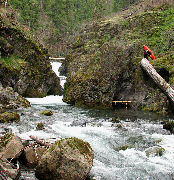
We put in at a great little primitive campsite at the first bridge over the Black Rock Fork ( we ended up camping there that night, it was a perfect spot! ).
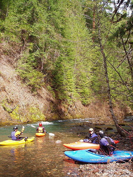
Brad, Megi, EJ and Gabe getting ready at the put in for the Black Rock Fork.
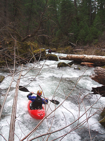
Just downstream of the put in the river was fast and a little brushy. We arrived at a small ledge and ran it off the middle, then the walls rose out of the river and we got out above the first big one to scout.
The entrance falls was a big disappointment. It was a real beauty, dropping about twenty feet over three tiers, but the middle tier was blocked by a large log. There was no possible line, so we grunted out the difficult portage on the right hand side. Not fun, but not what I would call a super-difficult portage either.
Figuring out the portage around the entrance falls.
Back down at river level, we launched in and ran the slides leading up to the next big drop, which was located about a hundred yards downstream of the entrance falls.
Ryan Scott runs the fun drops just upstream of Box of Rocks.
We got out to scout on the right and it looked good. This Falls is called 'Deer Lick Falls' by the locals, but Ryan got it right when he looked at it and said: "It looks like a box of rocks."
I climbed downstream to take photos, then James went first and then everyone else piled over it with a variety of results. Some got good boofs, others gutted it with big tailstands!
Ryan was so psyched he climbed down from the road to check out Box of Rocks during the shuttle.
Ryan Scott digs in for the boof at the bottom of Box of Rocks.
Gabe Flock blasts out of the bottom of Box of Rocks ( this was the most common result.. )
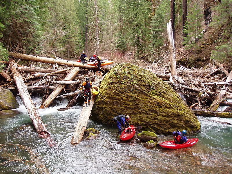
Downstream of Box of Rocks the river widened considerably. We ran some smaller drops, then arrived at a huge logjam blocking most of the river. "Uh oh.." I said. "Hope this isn't typical.." We climbed up over the middle of the jam and found a conveniently placed log that extended down into the pool below..
Portaging a large logjam downstream of Box of Rocks.
Below the logjam were some smaller drops, then a significant horizon line which appeared to be dropping into a very tight gorge. I got out on the left with high hopes but was soon disappointed, the twelve-foot falls dropped into a convoluted overhanging 'room', which then flushed downstream into a pile of boulders and wood. Really bad news in there, no way out once you go in.. We portaged on the left hand side.
Portage number three, around the Zodiac Gorge. This one was blocked by wood at the exit.
Downstream of Zodiac the river meandered for awhile then turned slightly to the right and dropped out of sight. Ryan and I got out on the left to scout, and he said: "Looks like go right.." I headed back upstream and bombed over this fun little drop and that was definitely the preferred line. The center line was suspect as the water plowed into some suspicious-looking boulders..
Megi Morishita plows through the hole at Go Right.
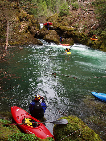
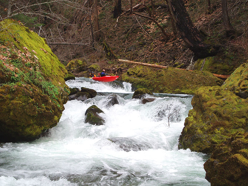
Downstream the rapids came with a steady frequency. Slides and boulder gardens..
Ryan plugs a fun little slide downstream.
Soon we arrived at a long, s-shaped boulder garden. We scouted it briefly and could see a large log jammed in the right side of the drop at the bottom, so it looked like left was the best line. Ryan probed. He reached the bottom and then got out, waving his arms. EJ went down halfway, climbed on a boulder on river-left, and got the scoop.
It turns out that the log actually extends across the entire width of the rapid, and forms an extremely deadly pin hazard on the left. The log is completely invisible until you are below the drop, at which point you can see that if you don't boof, you will be wrapped around the log like silly putty..
James runs a drop that ended with an invisible and extremely dangerous log while EJ directs traffic from the boulder downstream.
Below the nasty log drop were a great series of boulder gardens, all with clean boofs, totally classic whitewater..
James boofs a fun drop downstream.
Gabe runs a fun boulder garden just downstream.
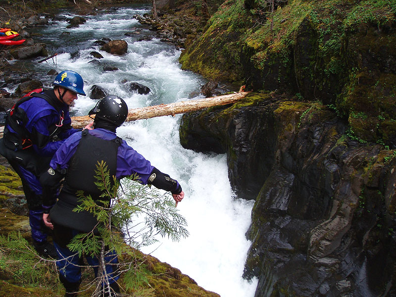
Below the fun boulder gardens the river mellowed briefly then we reached the edge of the world. I could see it coming from quite a way upstream. The walls rose out of the river, and the river dropped away with a tremendous roar. Whatever was waiting for us down there, we now knew why the road had run away from the river... it was afraid.
"Ohhh boy." I muttered to myself. "I hope this isn't the reason why we've never heard of this section being run.." We got out on the right and beheld the spectacle below us.
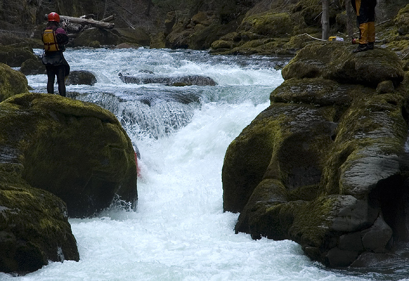
The group contemplates the big one.
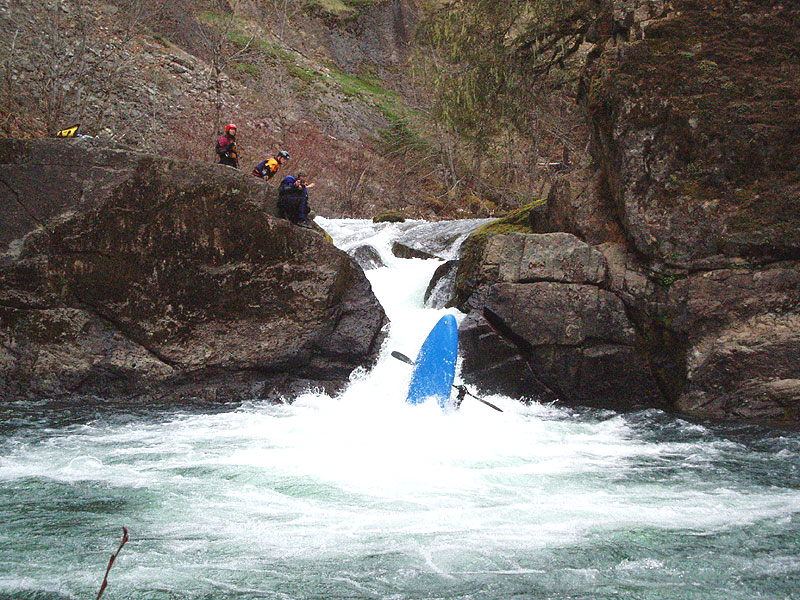
I think pretty much everyone decided to portage after looking at the entrance to this monster. The river narrowed dramatically and thundered down what looked like a pile of boulders into a narrow slot, then into a boiling pool, which fed into a nasty-looking eight-foot ledge. Only Ryan and James seriously looked at it, everyone else started grunting their boats up and over the high rock wall on the right. It was a long, long portage, and required some ropework at the end for lowering.
Ryan and Gabe scout the entrance drop.
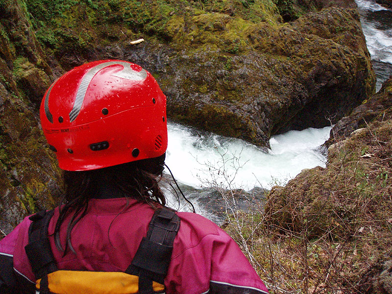
Megi checks out the bottom drop.
By the time I started to portage Ryan said that James was going to run this thing, so I yelled across to EJ ( who was the only one to portage on the left ) that James was going to give it a go and to get a rope. I hurried through the portage and decided to try and get a rope on the bottom ledge hole, which was boxed in and impossible to reach with a rope without traversing along the river-left wall.
I started traversing across the rock wall on river-left, and then I hit a blank spot. I was soaking wet and the wall was coated with moss, but I decided to go for it. I launched myself across the blank section, desperately scrabbling at the rotten rock on the other side. Predictably, the rock crumbled under my weight and I shot off the wall and plunged into the water ten feet below.
Undeterred, I swam back to shore and tried again. And again. On my fourth attempt I heard whistles and then James came paddling out of the rapid, looking up at me with a What the heck are you doing?!? look on his face..
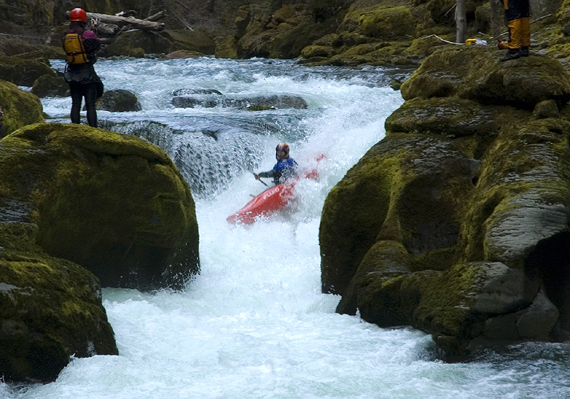
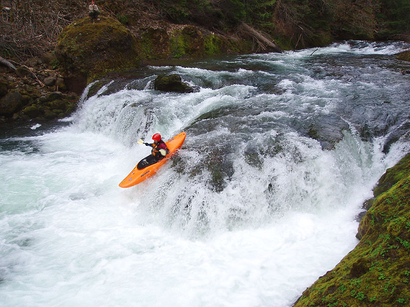
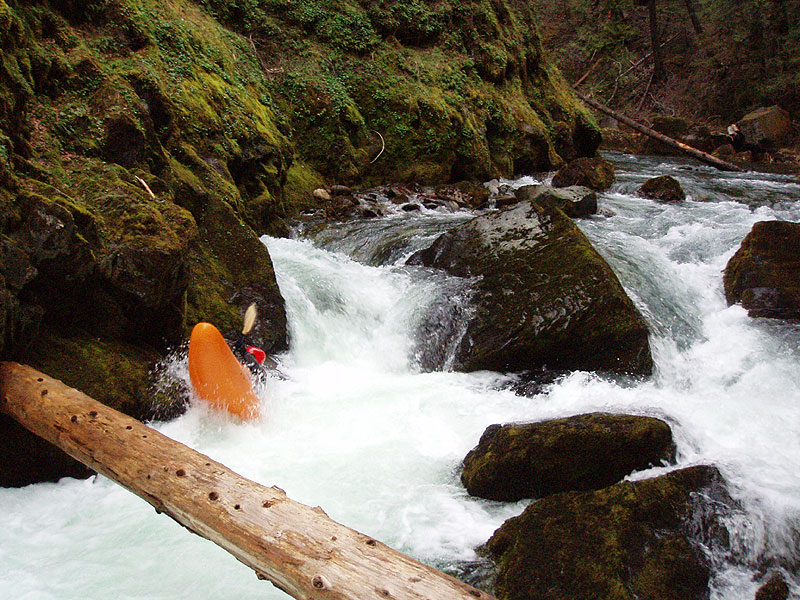
James Bagley Jr. runs the entrance drop on "Comfort Zone".
James punches through the nasty bottom drop on Comfort Zone.
EJ finishes up the portage below Comfort Zone.
James named this drop 'Comfort Zone' because he said it was located near Comfort Camp on the map, and because it was right at the edge of his Comfort Zone. Big Drop, great line! Kudos to James for firing this one up!
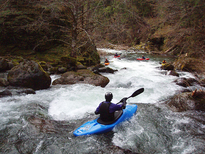
Downstream of Comfort Zone the river stayed scenic with a few more smaller rapids, and then the bedrock started to slide out of the water again and we reached another big horizon line.
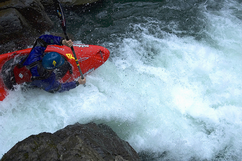
Once again, everyone got out on the right hand side to scout. "Holy Crap." I said. "It's on like Donkey Kong in there!". Below us the river dropped over a short, stout ledge that looked good to go, except for the fact that 99.999% of the water crashed violently into a huge boulder before careening down between narrow walls downstream.
Nobody liked this one except, once again, James. "I'm going to run it!" He said with a grin. Um. Ok.
Everyone got in position to set 'safety', but it was kind of like watching a car crash on ice when you know what is going happen and there's nothing you can do about it.. Yeah. "This is going to suck for James." I said to no one in particular, and I was right.
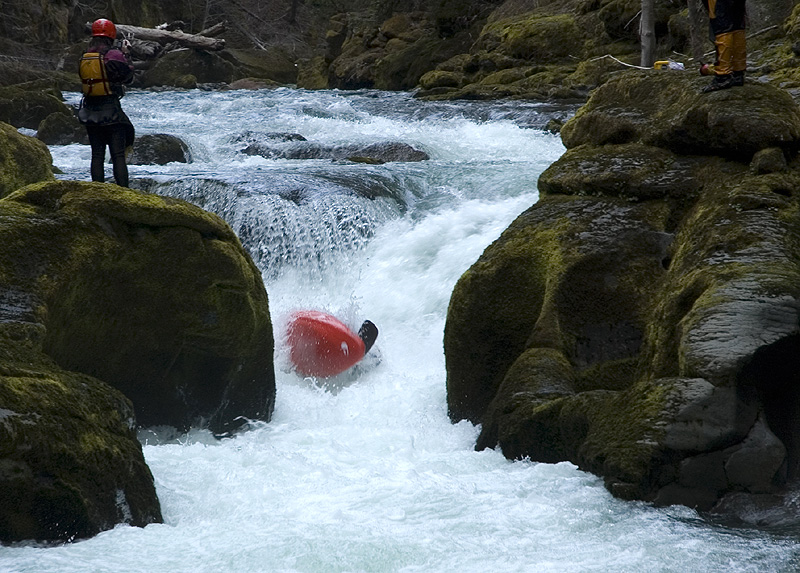
James came barreling down, boofed, and crashed into the boulder, pretty much according to plan, disappeared for a second, and was then forcefully ejected downstream, where he rolled up shaking his head and giving a thumbs up..
James Bagley Jr. makes the first known descent of "It's On Like Donkey Kong", a very violent drop with no good options..
James crashes into the rock on river-right, pretty much according to plan..
..and gets the forceful ejection!
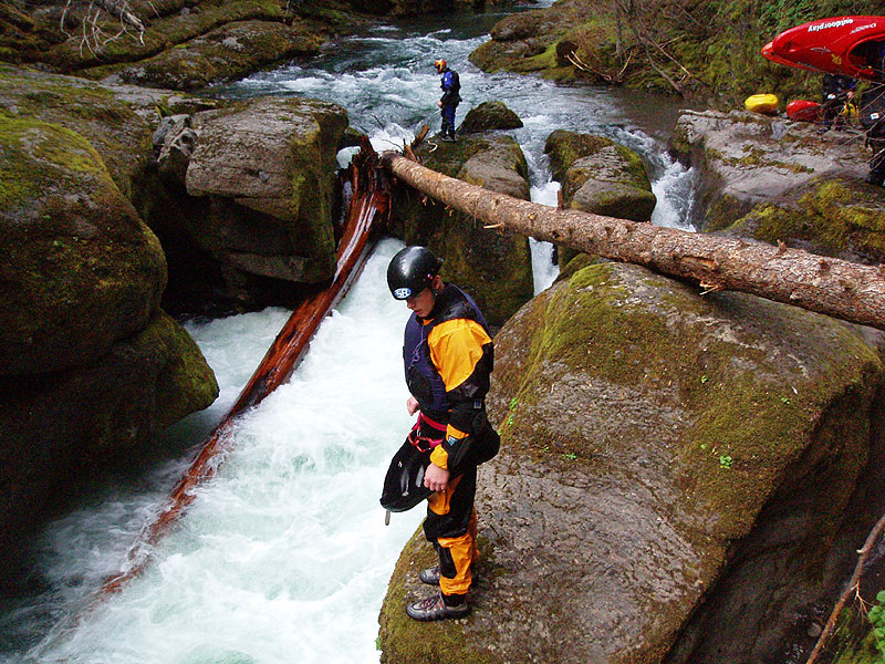
Just downstream of Donkey Kong the river flows through a fascinating series of slots, each of which looks worse than the next. I dubbed this one 'Filter' and nobody even thought about running this nasty little bugger..
James ( background ) and Brad ( foreground ) check out the mess at Filter.
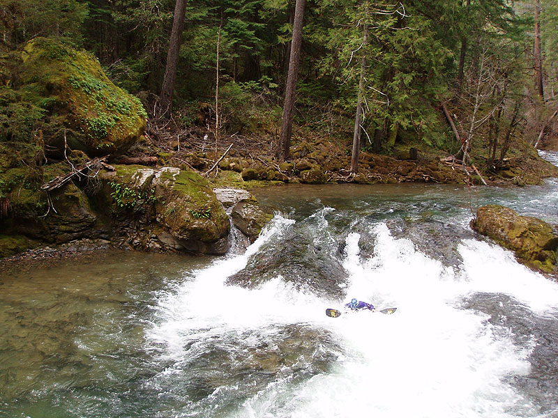
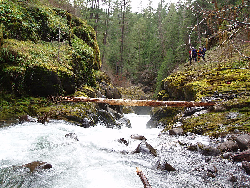
Downstream of Filter the road appeared on the right again, and we knew we were getting close to the cars. Sure enough, we soon saw a horizon line with a logjam below it which signaled the last drop of the day. We all ran the take out ledge without problems and were back at the cars with daylight to spare, not something we often experience on exploratory missions!
Megi runs the take-out ledge.
Overall, I would have to say that the Black Rock Fork is one of the best new runs we have discovered. Reliable spring flows, an online gauge, spectacular remote location, and great camping all make this one a winner.
We had 1,000 cfs on the South Umpqua at Tiller in March. This was probably about as low as you would want to go. We had a week of 60 degree temperatures and some rain leading up to our trip, which helped the flows. The river was actually dropping from a high of 1,500 the previous week. The Tiller gauge is downsteam below the confluence of the Castle Rock Fork ( a log-choked nightmare, by the way ) and the Black Rock Fork.
So, probably 1,500-2,000 on the South Umpqua at Tiller is a good flow range. Any lower and it would get too scrapy, and any higher and Comfort Zone might become unrunnable. This run also probably gets some snow on the road in the winter, but I'm not sure about that, or if it gets plowed. I'm also not sure how much of our water was snowmelt, and how much that skews the flows.
A good visual gauge is the take-out ledge. This drop is close to the road and easy to inspect before committing. It should look something like the last photo on this trip report. More water would be fine, but not too much less.
This drop will probably be runnable after the next big flood because I suspect the linchpin log will move downstream with high water.
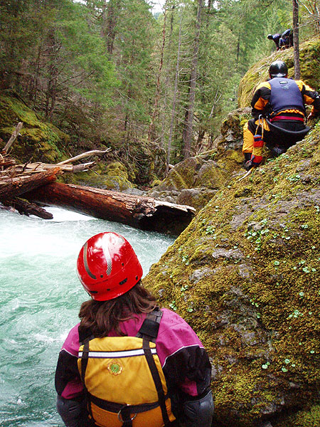

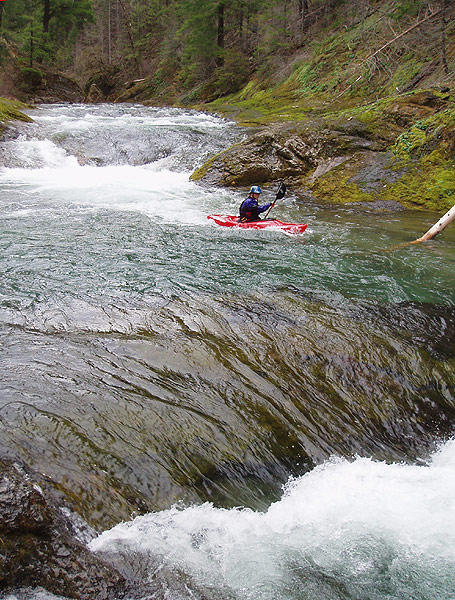
Photo by EJ Etherington
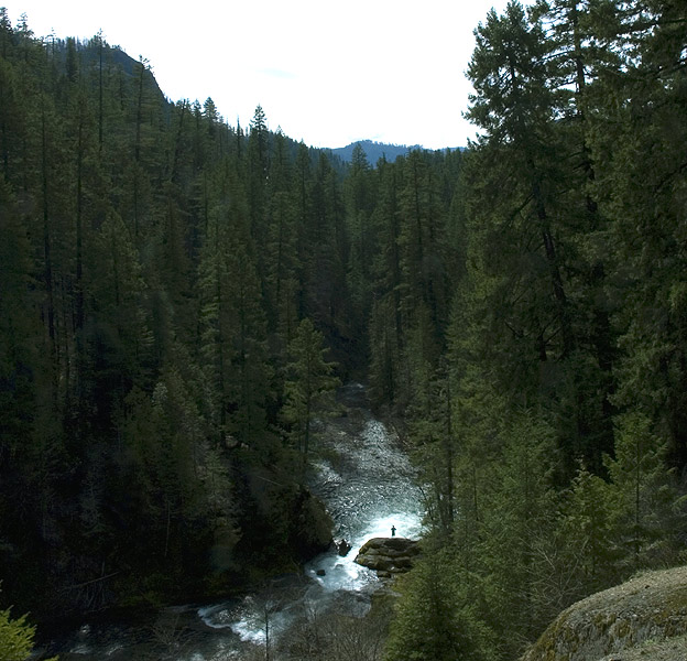
Photo by EJ Etherington

Photos By EJ Etherington.
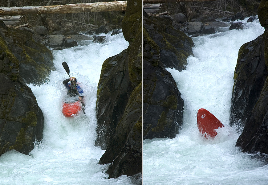
Photo By EJ Etherington.
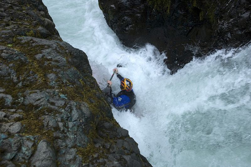
Photo By Ryan Scott
This drop is basically a car crash.
All three of the following photos are By EJ Etherington.