By Jason Rackley
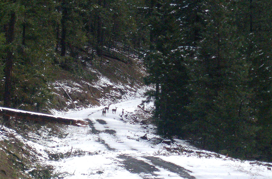
The South Umpqua drainage is remote. Very remote. There aren't any big cities nearby, and the little towns soon give way to an endless ocean of trees and mountains. Pretty much the world as it was intended to be. The farther we got from civilization, the more wildlife we saw. Herds of elk and deer rambled off the road as we rolled by in Jesse's van, not quite sure what to make of this odd vehicle with the brightly colored boats on top.
Finally we reached the turn off on the Black Rock Fork and headed upstream. Unfortunately about a mile up the road we hit snow, which meant we were still three miles short of the put in. I knew we had some serious elevation gain ahead of us, so we debated whether or not it would be worth hiking to the put in. Common sense made one of its rare appearances and we decided to go to plan B, the unknown upper stretches of Jackson Creek.
Back down the road, poring over the maps as we drove. I hadn't been down into the Jackson drainage since 1999 when I ran Upper and Lower Jackson Creek with Mike Haley, so it was a bit of a hit-or-miss proposition.
We saw herds of deer and elk on the way up to the Black Rock Fork.
After an hour or so of backtracking and driving up Jackson Creek, the creek dropped out of sight and we started thinking about putting on. I had almost no beta on this section, other than some vague observations from Dan Coyle way back in the day that "I saw some pretty steep stuff up there" or something like that.
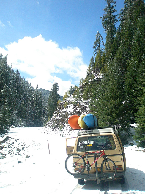
Anyway, we finally hit snow again and started back down the road looking for a reasonable put in. Finally after a few starts and stops we found a spot where the scramble down to the creek looked somewhat reasonable.
Trying to find a somewhat reasonable place to put on Upper Upper Jackson Creek.
We geared up and began to slip and slide down the steep cliff wall to the creek, arriving at the bottom a minute or so later. The creek looked congested with a few hundred cfs sluicing downstream through some big boulder jumbles.
After making a half-hearted attempt to warm up we got into our boats, deciding that the best way to warm up was to paddle!
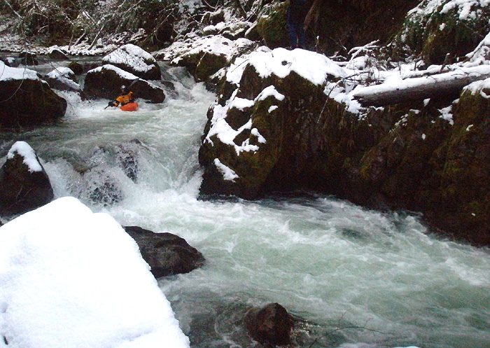
Almost immediately we were out of our boats, scouting the first big boulder choker.. It was good to go, and we boofed our way downstream..
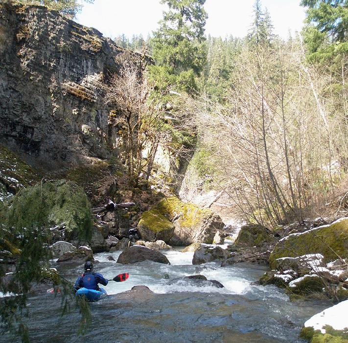
Jesse threads his way through the narrow upper sections of Jackson.
The creek was very congested and there was some wood to dodge but nothing too bad initially.
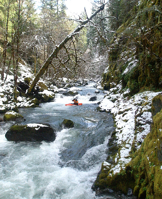
Steep and tight on upper upper Jackson.
Soon we ran into a big logjam, and portaged on both sides, temporarily dividing forces in the interest of time management. Downstream were more fun rapids, clean and fun.
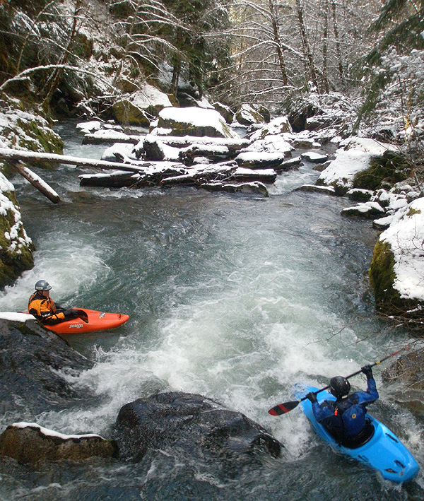
Pool and drop action section in between the steep stuff on upper upper Jackson.
Somewhere below the logjam the creek stopped being 'Upper Upper' Jackson and became just 'Upper' Jackson. I'm pretty sure the boulder garden in the photo below is on Upper Jackson Creek, which is in the guidebooks. I hadn't been on Upper J for about nine years, but it looked somewhat familiar.
Pete heads into another steep section on what was now upper Jackson.
Soon the bedrock started to appear and I started remembering some of the rapids, confirming that we were indeed on Upper Jackson. I had forgotten how much fun that section was. Too bad it isn't closer to Portland!
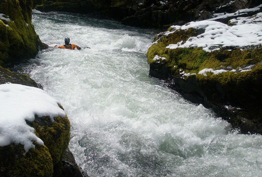
Jesse cruises through a narrow drop on upper Jackson.
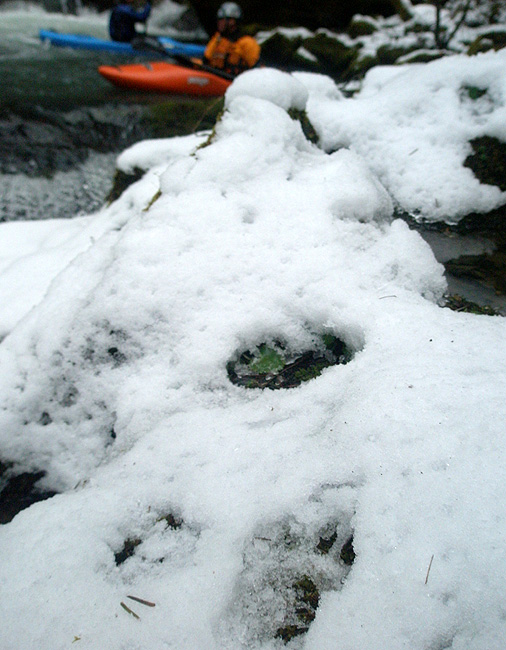
Soon we arrived at a funky drop with a log-boof combo. I got out to scout, direct traffic, and take photos while Jesse and Pete waited for guidance. As I worked my way downstream, I was pleased to see some Bobcat tracks in the snow, and fairly fresh ones at that! Very cool..
Some sort of cat tracks in the snow, either a Bobcat or a small Cougar.
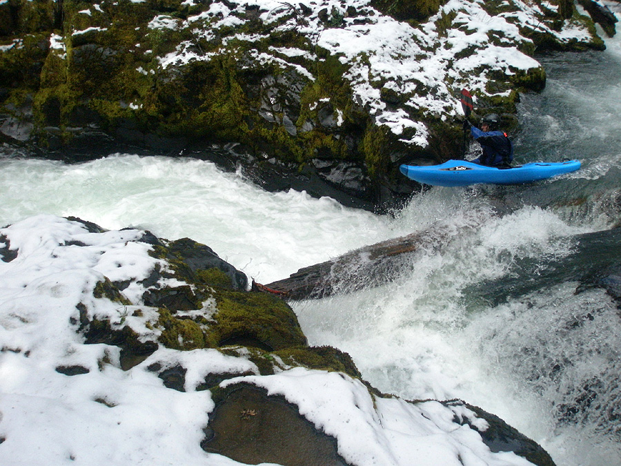
Jesse and Pete both dropped the log-boof drop without problems, and I followed after getting photos.
Pete negotiates the tricky log-boof combo..
Below the Log-Boof we ran some more drops then took out at Cover Camp. After a quick shuttle we found a campsite and crashed out, looking forward to the following day on Lower Jackson.
ACCESS: After turning off South Umpqua Road, drive up FS 29 for about twelve miles to Cover Camp, the take out. Get back on FS 29. Parallel the creek for about seven miles, or until you find a good place to put in. These directions will get you on Upper Jackson. To run Upper Upper Jackson, keep going up the road for another couple of miles or until you find a reasonable spot to climb down to the creek.
GAUGE: Based on the size and drainage of Jackson Creek, we estimated the flow on the upper section to be about 8-10% of the flow of the South Umpqua at Tiller. An absolute minimum flow would be 1,200 cfs at Tiller; 2,000 cfs would be a great ride.
They weren't sure what to make of us..