In early November 2007 a storm swept across the Pacific Northwest, bumping up the local rivers. This first big rain of the winter season got everyone talking about creekboating, but our excitement was short-lived. Late in the week the rain stopped, and most of the rivers dropped out immediately. Luckily for us, one of the more obscure steep creeks in Washington kept running, and we were psyched to finally be able to paddle it.
Sullivan Creek is dam-controlled, and there is a reservoir draw-down period starting in October which ends when the lake reaches a predetermined level. This makes Sullivan a good option in the usually dry fall when paddlers are looking for something different to do. However, the reliable flows in Sullivan may not last much longer.
The Sullivan Creek Dam was built in 1909 by the Inland Portland Cement Company. This dam and the surrounding infrastructure now sit idle, generating no power. The license for this project expires in 2008, which means the dam is now in limbo. American Whitewater, the Kalispel Tribe, and the U.S. Forest Service have joined together in negotiations with the Public Utility District that controls the dam to determine its future.
Sullivan is located in the extreme northeast corner of Washington, a long, long way from the western Washington and Oregon population centers. Because of this, the creek is not well known outside Spokane paddling circles. It takes some serious convincing to get paddlers to make the drive from Hood River, much less Portland or Seattle.
At the beginning of the week we had a six person group, counting myself, ready to go. One day before departure three had dropped out and Keel was MIA in Idaho somewhere. Luckily at the last minute Keel rolled back into town, full of stories from his east coast kayaking tour.
Scott 'Fish' Waidelich called as we were driving east on I-84 and said that he had convinced the Seattle crew to rally out to Sullivan Creek for the full weekend. Since Scott and company weren't leaving until 9 p.m., Keel and I decide to camp at Palouse Falls State Park and finish the drive the next day.
Camping near the huge drop known as Palouse Falls on the way to Sullivan Creek.
As usual, I underestimated how long it would take to get to Sullivan and we arrived late on Saturday morning.
Rolling into Metaline Falls late Saturday morning. This old movie theatre is located about a half mile from the take out for Sullivan Creek.
Luckily the boys were at the put in and just getting into their gear when we arrived. They had already scouted the first few drops via a trail that runs down river right about a half mile down the creek.
The crew getting ready at the put in campground.
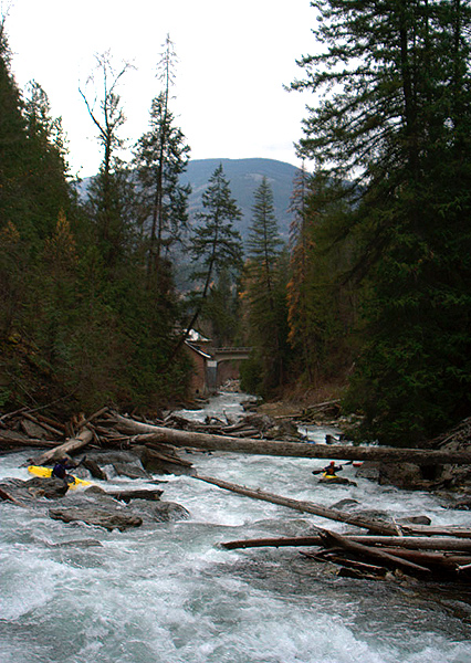
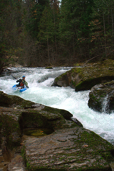
We ran shuttle then set off down the creek, six strong. The first rapid is known as 'Thumper' and it comes quick, just around the corner from the put in. Thumper has a strong diagonal at the top that kicks into the left wall then the bottom portion pinches up a little wider than a kayak width. Once below Thumper the pace was pretty fast as we headed downstream.
Brian Vogt enters Thumper, the first significant rapid on Sullivan Creek.
Just downstream from Thumper was a daunting horizon line. Since the rest of the crew had already scouted, so James and Brian dropped in and disappeared downstream. Keel and I jumped out to scout just as Scott dropped into the second half and reappeared below the drop swimming, but holding all of his gear.
There are a few logs that make up the top ledge, which drops about six feet into a fast moving and swirly pool just above a cluster of boulders. The creek drops another six feet over the boulders and flushes into a fast-moving runout. Keel and I quickly ran this drop without problems.
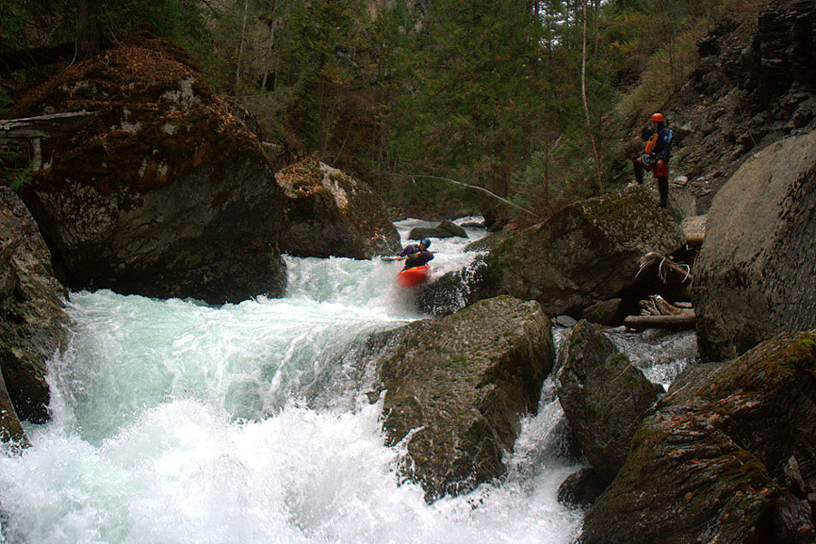
After a quick self-rescue Scott was back in the water, though this drop was to become his nemesis for the weekend.
The local boys have named this rapid 'The New Slide' as it was created by a landslide in 2006, though we nicknamed it the 'Fish Bowl' in light of Scotts troubles here.
At this point Brian opted to take out while there was still a trail close to the river because he was getting pushed around in his IK. The next few rapids were pretty straightforward, then we arrived at 'Two Log Plop'.
TLP starts with a ledge at the top with a huge boulder blocking the main flow just downstream. This blockage creates a challenging boil that requires a strong run over the right side to avoid getting caught in the terminal eddy on creek right. If you are forced into the eddy, you have to ferry back out in order to run the the remainder of the rapid, as seen below.
The author runs the bottom of 'Two Log Plop'.
Just downstream was Zig-Zag. We were able to boat scout this fun drop and most of us went right down the middle.
Dave Moroles at the bottom of 'Zig-Zag'.
Some fast-moving class two swept us through a few turns in the canyon and we were able to relax briefly before the creek really kicked off. Soon the walls rose out of the water, locking us in as we hit an eddy on creek left. From the eddy we could see an almost certain portage around a massive log jam that blocked the entire creek below.
Just above the logjam is a drop known as 'The Plug', a small ledge with a run-out that flushes straight into the log jam. There are eddies on both sides, but the portage is on creek-left.
The author approaches 'The Plug', which flushes directly into the logjam visible downstream.
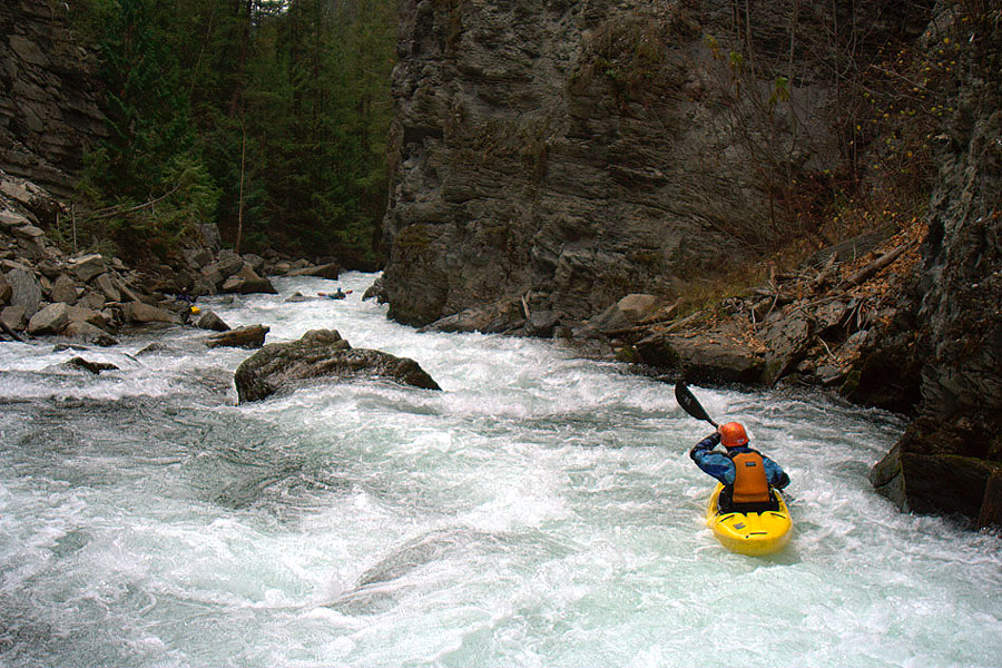
As we made our way over and around this logjam I was reminded of the logjam blocking the gorge on Hagen Creek. Looking downstream from the logjam the creek was a blur of white, marking the rapid known as Stairstep. From the portage we could see an eddy downstream on creek-left, just before the creek took a left turn around a blind corner.
The guys who had run the creek before said that we had to catch that eddy, or you would be swept into a really hard rapid known as 'The Tooth'.
Dave Moroles enters 'Staircase'. The must-make eddy is visible downstream on the left.. Don't miss it!
I had hoped that the log jam above the canyon would collect all the wood and that the next section would be clear of logs, but the Tooth had a big log blocking the main line.
From our scout there was a line through the lead-in ledges and down to a must-make eddy just above the portage rapid on the left. Keel and I decided to run the lead in and hit the eddy above the main drop while the rest of the group hit one upstream of this after running 'The Squeezes'. It was a fast and pushy ride with an 'oh s--t moment' at the end, but we both arrived safely in the eddy.
The author hits the must-make boof to reach the portage eddy above the crux of 'The Tooth'.
A closer look at what is waiting for you at the bottom of 'The Tooth' if you don't make the eddy.
I jumped out and started the portage up and over a small logjam on the creek left bank. As I reached the top of the logjam I slipped and fell about seven feet onto the boulders below. As I fell I threw my boat over my head and luckily it was stopped by a rock just over my head as I came crashing down. Luckily I wasn't hurt so I shook the fall off and walked away from a near-disaster in the deepest part of the canyon.
A couple more read-and-run rapids led up to the top of the final set, Itchy and Scratchy. These are the ledges pictured in the Bennett guidebook. However it appears that the tall, pointed rock in the last drop in the guidebook photo has rolled downstream. This boulder shift makes the main ledge a little taller and the last drop a straight shot down the middle, bouncing off the pillow created by the re-positioned rock.
The author flies off the main ledge at 'Itchy and Scratchy', from the front..
And, from the side..
James looked around the corner and came back with a smile, saying 'the take-out bridge is right there'. At this point that was huge relief since we were running out of daylight. However we did have time to set up and take our time finding the line through Itchy and Scratchy.
James and Scott went first, cleaning the set of rapid from top to bottom. David put in right after the lead in drop via the scout trail on creek left and also had a good line. Keel and I went last, after shooting photos of everyone.
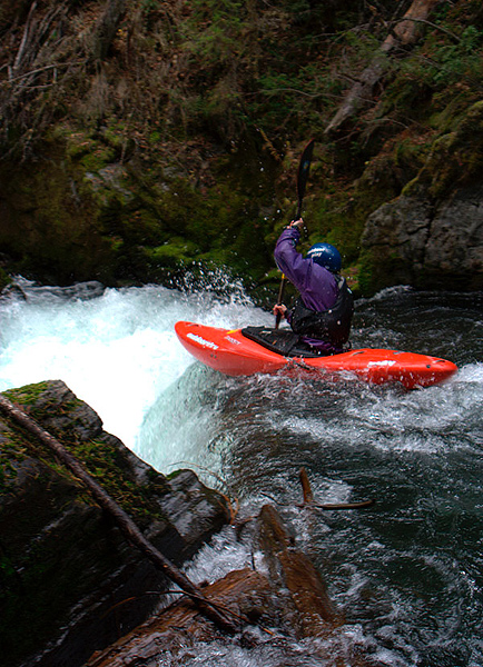
Just downstream from Itchy and Scratchy is a nice boof flake that sent us all flying out in one last 'That was the s--t moment'.
The author hits the boof flake in one of the last rapids above the take out.
As we turned the corner there was one rapid downstream with a log in the middle of the creek and the current zig-zagged it's way into it. We all ran this drop but most of us were pasted into the log and surfed away from it. This was a little sketchy, so this drop is probably worth a scout once you get there.
The Final drop is right beside the old Powerhouse and has been called The Powerhouse Plunge. PP is a fun six foot ledge that can be run pretty much anywhere.
James and Dave run the lead-in to the 'Powerhouse Plunge'.
Just downstream of the Powerhouse is the take out on creek left at a nice pull out beside the road.
This Creek really surprised me, it has quality and a fun guaranteed flow in the late fall when almost everything else in the state has dried up. It is a long, long drive, but the camping is good so it is a worthy trip if you plan on spending a few days in the area.
For information on the fall release you can call the Box Canyon Dam at 509-447-6706. We had a flow of 200 cfs coming out of the dam which mixed with the natural flow. All told this meant there was an estimated 300-350 cfs in the creek.
For a first time level I don't think you want more than 400 cfs. Once you know it a good maximum level would probably be around 500 cfs. It was starting to get pushy at 350 and another 200 cfs would turn it into an entirely different run!
I have heard from the locals that Sullivan can run year-round. It has been run lower than 150 cfs, but it has a tendancy to create ice dams in the winter. There is an online gage for current flow reports.
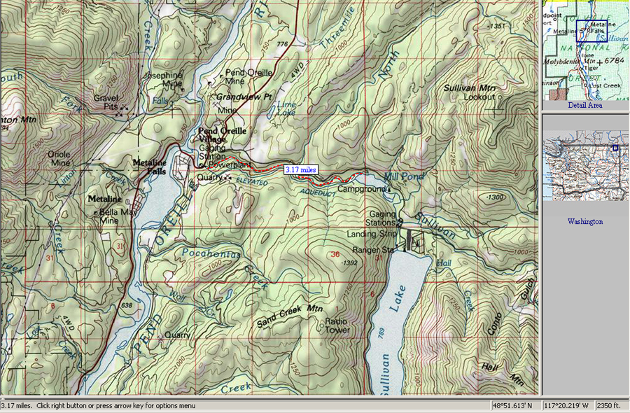
Take-out: From Hood River, 84 East to 82 North to 395 West past Spokane to hwy 2 North to hwy 211 to hwy 20 North to Metaline Falls. Go past the town on Metaline Falls on 31 to the power station at the bridge that crosses Sullivan Creek. There is a pullout just downstream of the powerhouse on creek left, take out here.
Put-in: Keep going up hwy 31 another two miles and take a right on Sullivan Creek Lake road. Go bout another three miles until you see the creek come into sight on the right. The first unmarked campsite is the put in. There are a couple more unmarked camp grounds upstream that can be used as a put in as well. The rapids start just downstream from the put in.
Sullivan Creek
For complete directions to the put-in and take-out, as well as other info, pick up the second edition of the bible, Jeff Bennetts 'A guide to the Whitewater Rivers of Washington', a book no serious Northwest paddler should be without. You can pick this book up at your local paddling shop, or on amazon.com.
Photo Copyright © Keel Brightman
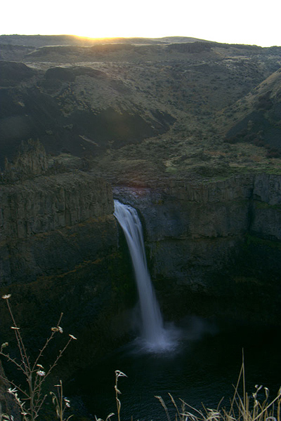
Photo Copyright © Keel Brightman
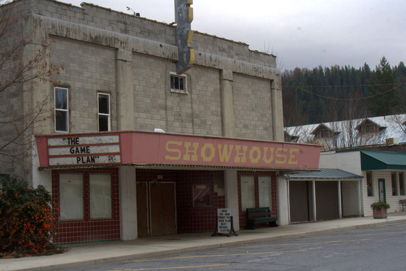
Photo Copyright © Keel Brightman
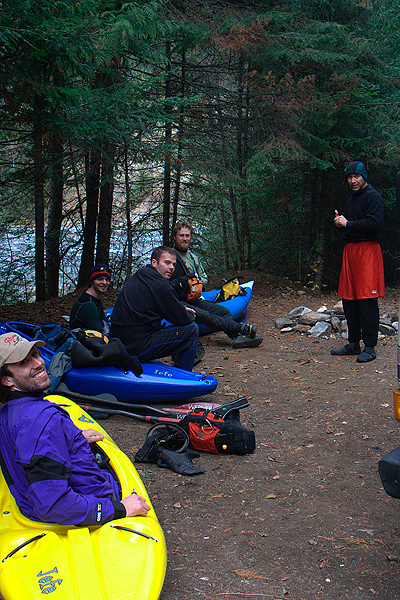
Photo Copyright © Keel Brightman
The author enters 'New Slide' aka 'Fishbowl'.
Photo Copyright © Keel Brightman
The author halfway down 'New Slide' aka 'Fishbowl'.
Photo Copyright © Keel Brightman
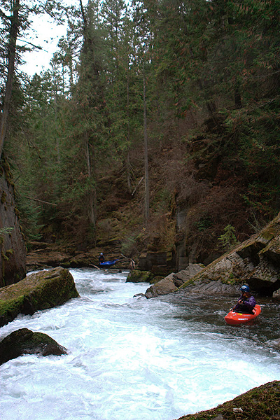
Photo Copyright © Keel Brightman
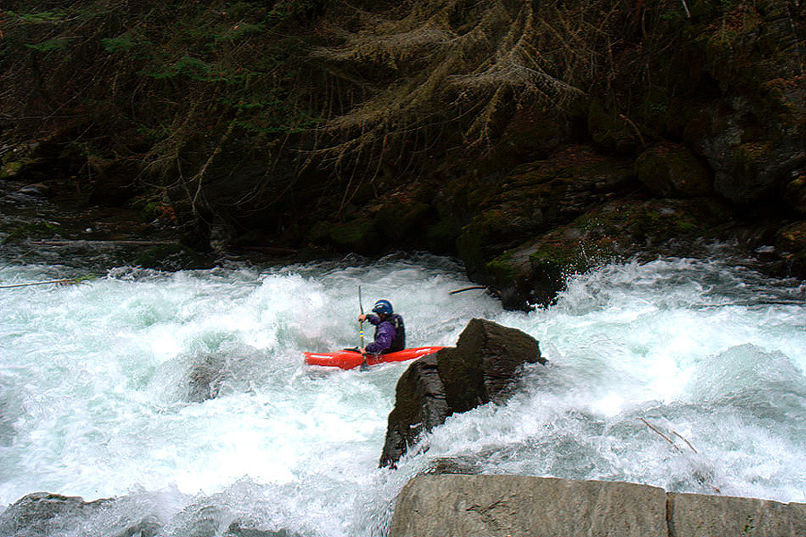
Photo Copyright © Keel Brightman
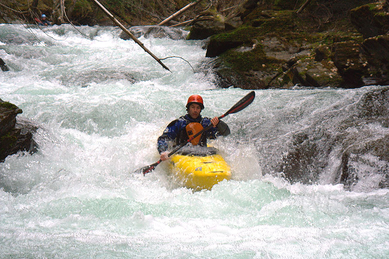
Photo Copyright © Keel Brightman

Photo Copyright © Keel Brightman
The Tooth is currently unrunnable because of a log blocking the main line.
Photo Copyright © Keel Brightman
Usually there is a line on the right against the wall, but in this photo you can see the log currently forces a portage.
Photo Copyright © Ryan Scott
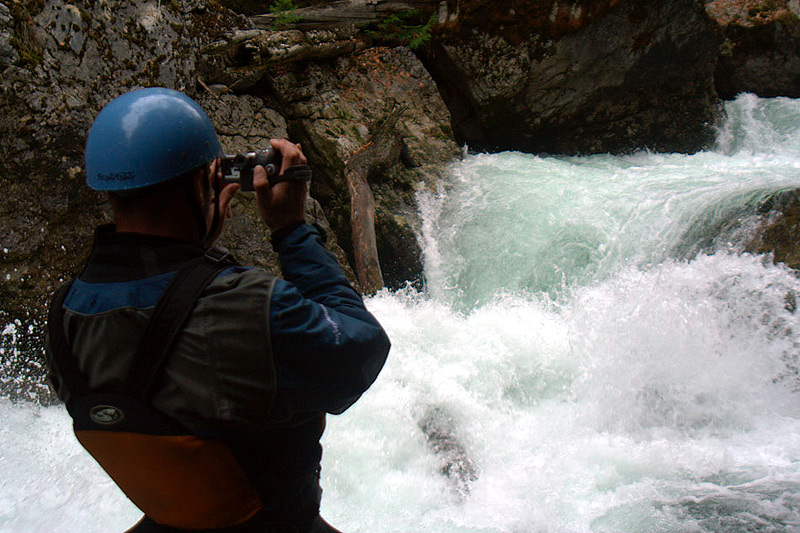
Photo Copyright © Scott Waidelich
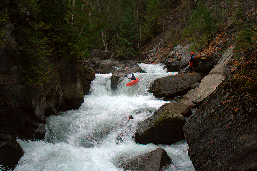
Photo Copyright © Keel Brightman
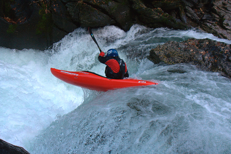
Photo Copyright © Keel Brightman
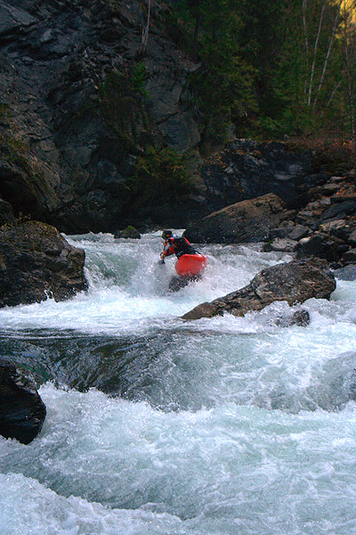
Photo Copyright © Keel Brightman