An account of the first known descent of Pyramid Creek
James Bagley Jr., Jason Rackley, Mike Long, Pete Giordano
Location: Oregon Cascade Mountain Range, Headwaters of the Middle Santiam
Class: IV+ ( V )
Gradient: 143 fpm average, steepest middle section 190 fpm
Length: 4.75 miles
Flow: 1,000 cfs estimated
Torture Factor: High
Each of us has scouted or attempted to scout Pyramid over the years, but we always ended up scouting the wrong fork, getting lost, or running into snow. A few times one of us actually managed to peer in and see bits and pieces of the actual creek, but the majority of the creek remained a mystery.
The logistics associated with a run down Pyramid are daunting. There are no roads accessing the creek, so you have to hike in and out of the canyon. The nearby wilderness area forces a huge, time-consuming shuttle that consumes precious daylight needed to complete this run on the short fall days when the roads are free of snow. Snow is the major limiting factor for Pyramid; once the freezing levels drop the roads become impassable. So, there are perhaps one or two weekends in the fall each year when a run down Pyramid is possible, when the rains fall and the freezing levels are high enough to keep the roads open.
Finally, James Bagley Jr. decided enough was enough and committed to figuring out the logistics for Pyramid once and for all. After several days spent climbing around in the canyon, James found a reasonable spot where we could hike in from the creek-right side above the Scar Creek confluence. James then arranged to have his friend Ken Eshelby pick us up at the confluence of the Middle Santiam, sparing us the mega-transect shuttle. However, James only solved the access problem. The nature of the creek itself remained a mystery.
The day before we put on the creek the rain was pouring down, the gauges were redlining, and we were psyched. James sent the following email with an attached map of Pyramid before heading up to camp near the put-in:
|
Ok gentlemen, here is your creek should you choose to run it.
The red line represents 4.75 miles of creek from put-in to the confluence of the middle santiam wilderness run. I don't actually know where the take-out is in relation to the confluence. Our put-in is just upstream of Scar Creek, which will almost double the flow. There are no reasonable hike-out options. Whatever vast quantities of wood we run into will need to portage. Whatever runnable whitewater we encounter will need to be run. :-) more later, -james
|
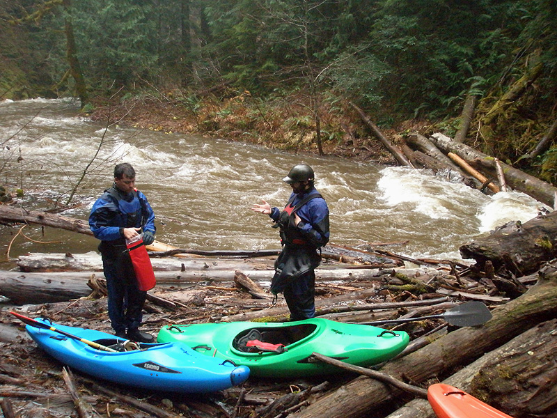
Time is a scarce and valuable resource when you attempt a run like Pyramid. Mike Long, Pete Giordano and I met at 5:15 a.m. in Wilsonville. We piled into Mike's Suby and were soon headed south, still feeling a little fuzzy from the early morning start. James was camping near the put-in, and we were all feeling a little envious that he was still sleeping up in the mountains somewhere.
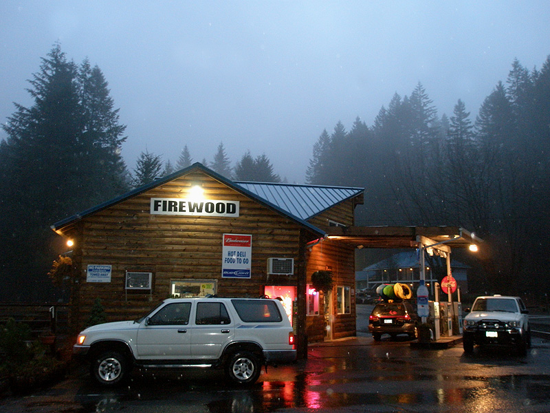
When we reached the tiny mountain hamlet of Detroit we gassed up and headed into the mountains.
Gassing up before heading up into the mountains in the tiny town of Detroit.
We hooked up with James and drove down a series of roads until we saw a small road ( road 350 ) going off to the left. This abandoned logging road would get us 'somewhat close' to Pyramid, according to James.
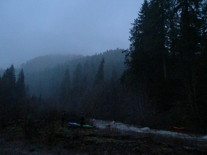
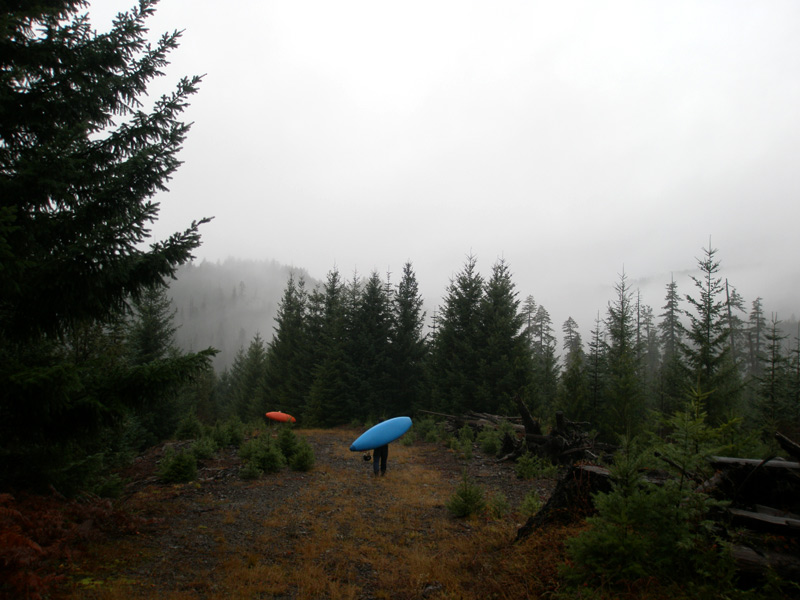
We loaded up our gear and started walking. The first leg of the hike was on the old road and went fairly quickly. Soon the road ended and we were slogging down into the canyon through the thick brush.
Hiking in to Pyramid Creek. This abandoned logging road ended just below this spot, then we were in a pristine canyon.
After much steep slogging through the dense tanglefoot we arrived at the creek and saw wood everywhere. Upstream, downstream, in front of us, standing vertically all around us, the logs had us completely surrounded.
While we digested this fact, James said: "Where's Pete?"
Where was Pete? He had been behind James, but now was nowhere to be seen.
We waited a couple of minutes then started milling about, calling out to him, etc, before we got organized and hatched a semi-cunning plan. We would regroup in a half hour, James would go upstream, Mike downstream, and I would go back up the hill.
One long whistle blast meant you hadn't found him, two blasts meant you had. Signal your status every minute or so.
Ready: Break.
I headed back up into the tanglefoot and fallen logs, and soon arrived at the spot where James, Mike and I had descended. I grew up in a forest so I spent a lot of time tracking animals as a kid so I decided to try and track him.
I started casting back and forth on either side of our trail and after about ten minutes found a slight footprint about fifty feet off to the right.
I followed the logical fall line downhill, closely examining the occasional rock. After about five minutes I hit the jackpot, a faint whisper of blue plastic that meant Pete had passed through here. Now I knew he was upstream of us and Mike was going to find him.
Sure enough, about ten minutes later I heard two faint whistle blasts from upstream and I scrambled back down and soon rejoined the group at the put-in. Pete was downstream, and Mike had found him after a bit of hiking.
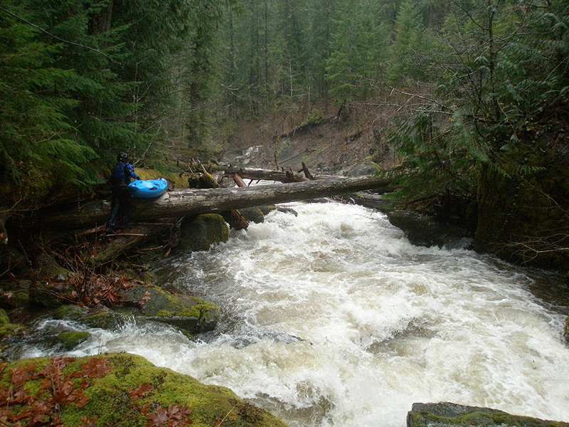
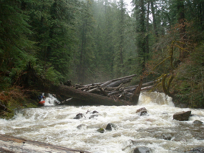
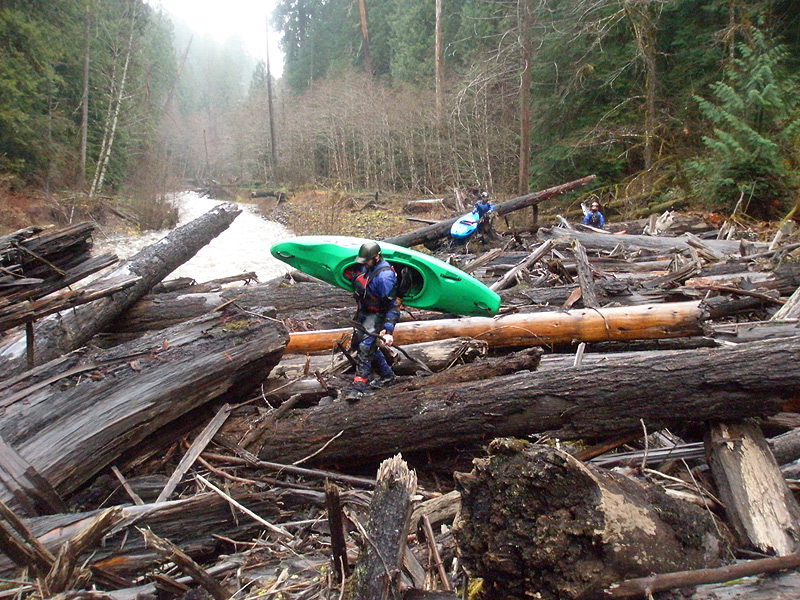
Scar Creek is aptly named, because this side stream has utterly obliterated the right side wall of the canyon where it flows into Pyramid. The resulting rapid is a huge mess of logs, boulders and sieves. We portaged on the left with minor difficulty, putting in below the worst of it and continuing downstream.
Pete beginning the portage around Scar Creek Rapid.
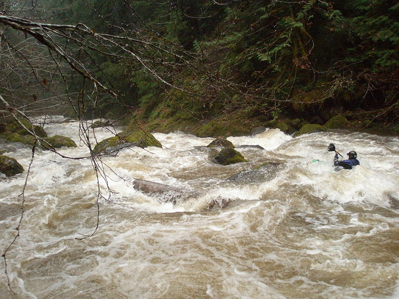
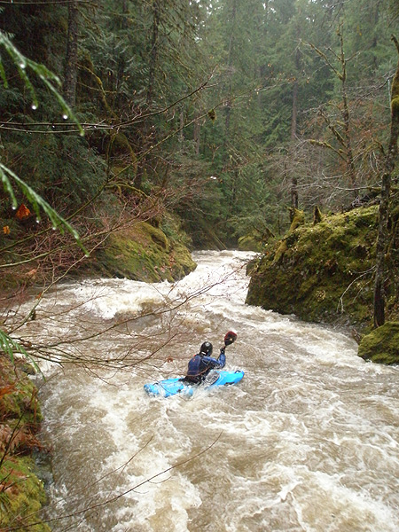
Once below Scar Creek the creek felt big and pushy. Eddies were few and far between, and the walls locked us in so we couldn't properly scout from the banks. We got out where we could to find the next eddy downstream, then we would send in a probe unit to catch the eddy and check the next corner. Sometimes we were able to scout, but then the walls would shoot up again and we would have to send in a probe unit.
Ordinarily this wouldn't be a big deal, but the high water reduced the margin of error to zero and made each probing mission a potentially life-threatening roll of the dice. It was clearly understood that a swim for the probe meant the least you would lose is your boat and there would be very little hope of rescue. Suddenly the mood shifted, going from 'having fun' to 'very focused'..
Mike Long rolls the dice and heads into the unknown below Scar Creek rapid.
The walls locked us in so we couldn't thoroughly scout from the bank, so we had to send probes downstream to the next eddy and rely on hand signals to communicate from there.
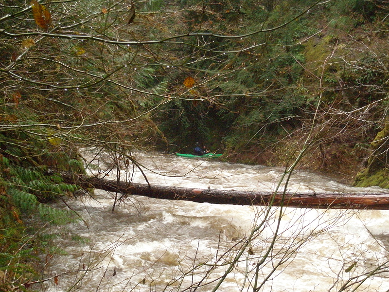
Soon we arrived at a big logjam which had one of the biggest logs I've ever seen as its linch pin. This logjam was actually kind of cool because it had this stompin' waterfall that emerged from the logjam on the creek-left side..
James Bagley Jr. portaging the waterfall logjam. That runnable-looking falls on the creek-left actually emerged from under the logjam, so it is a no-go. Look at the size of the linch pin tree James is standing under!
Just downstream of the waterfall logjam we took a breather and ate some lunch at yet another logjam. The walls had peeled back here, so we were able to scout much more carefully than upstream.
Taking a breather in a rare flat spot on the upper section. Mike and Pete trade paddling war stories.
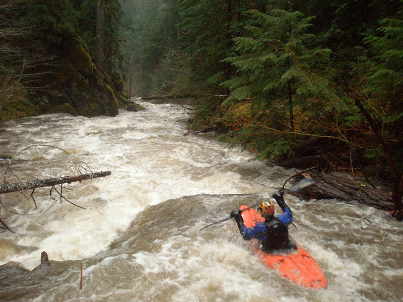
Below the lunch break logjam we arrived at a big horizon line. Luckily there were no walls here and the old growth trees marched down either bank, making scouting easy. We started scouting what turned out to be an enormous boulder garden. After hiking a couple of hundred yards downstream, James said: "This thing is like the Never Ending Story.." This rapid was big and complex and hard to describe. You just have to see it..
James Bagley Jr. nails a key boof about halfway through 'The Never Ending Story'.
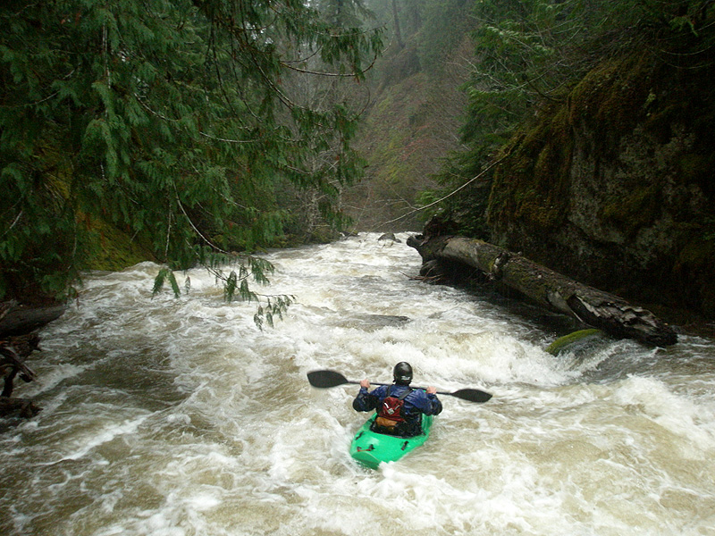
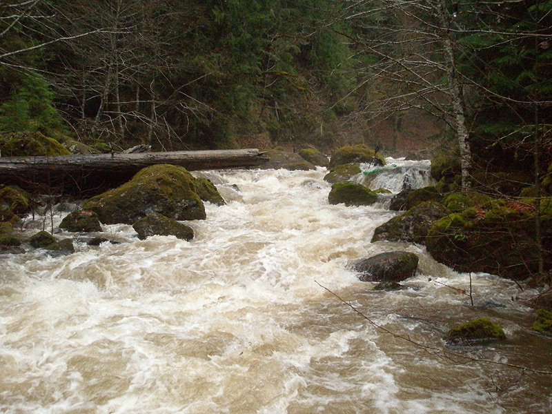
Mike Long hits the boof halfway through the entrance rapid of NES.
Mike Long runs the lower half of NES. This photo was taken from the same spot as the above picture so you get an idea for the size of this rapid ( and, these two photos only show about half of it! ) The two criss-crossing logs barely visible on the left of this photo were a severe hazard, with all of the water pushing into them from the runout below the boof move..
Below NES the creek kept up a frantic pace and the walls closed in again..
James Bagley Jr. steps up and probes the next gorged-out section below NES.
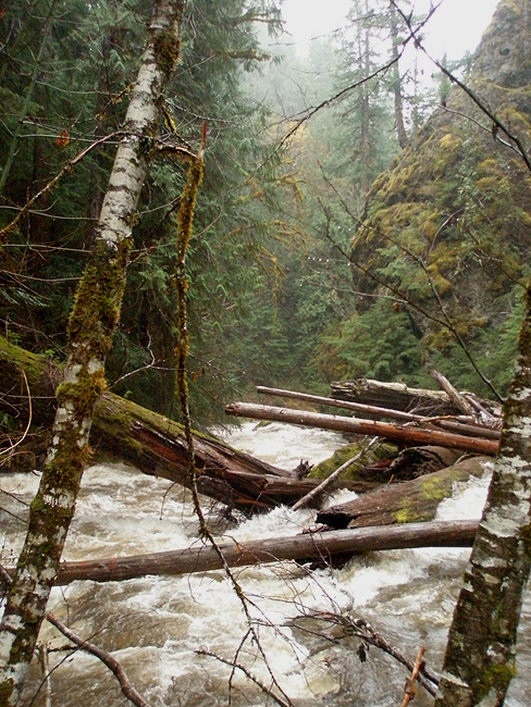
Soon we arrived at the most committing section yet, a crazy criss-crossing pile of logs with walls towering overhead on either side. We stopped well upstream and crept down the creek-left wall and were soon peering into an intimidating gorge.
The entrance to this gorge was pretty sketchy. Below the logjam at the entrance the creek roared down into a log sieve against the right wall, very dangerous. The problem was you couldn't stay left from the top because of the boulders guarding that side, so you had to start middle and charge hard to the left to avoid the sieve at the bottom.
Below this entrance rapid the creek tore to the right around a ninety degree turn between vertical walls.
We could see an eddy below the entrance drop on the left, so James decided to probe the entrance and try to make the scouting eddy. The put-in for the entrance was super sketchy, you had to balance on this log against the wall ( the little log blocking the current pictured below ) and then seal launch into strong current pushing against the left wall.
The entrance to Thunder Gorge. This was the single most intimidating section, starting with a super-sketchy seal launch against the left wall off of the little log blocking the current below, and then off into the unknown..
James ran the entrance fine and then I followed. Mike came down next, then Pete.. Overall I would say this entrance drop was probably my least favorite rapid on Pyramid Creek due to its severe consequences.
While James and I were standing in the gorge waiting for Mike, we heard an enormous rumble across the sky. The storms were still rolling through, and the thunder above combined with the thunder of the creek to create an impressive cacophony echoing off the walls all around us..
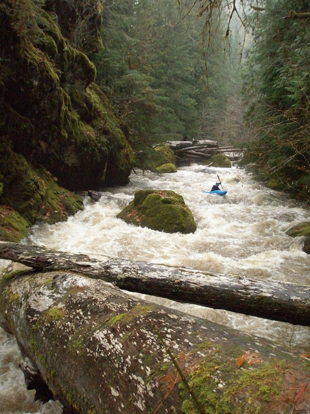
Pete makes the do-or-die move to the left to avoid the log sieve against the right wall in Thunder Gorge, shot from the huge limbo-log.
Pete squares up on the the next drop in Thunder Gorge.. big hole in there. This photo shot from the same spot as the one above.
Our luck was bound to run out, and it finally happened just downstream of the entrance to Thunder Gorge.
I was leading and I got out to scout a corner. Once out of my boat I could see pretty far downstream, and the section below appeared to be relatively straightforward. Below me the creek snaked down between the walls through several slight curves. There was a blind spot on a slight left corner I couldn't quite see, but below that the creek curved back into view and it looked clear. Mike got my verbal beta and probed.
All day, before and after this section, moves like this were common because of the nature of the creek and the pressing need to drive. If we had attempted to scout all of the drops from the bank, running the creek would have taken several days. We had to rely heavily on our skills as our downstream progress became a race against time.
Mike peeled out, ducked under a mid-stream log, then suddenly charged frantically to the right side into the tiny, surging, one-boat eddy against the right wall I had identified during the scout.
Mike sat there for awhile, peering downstream over his shoulder and trying to grab the vertical wall next to him. We found out later that there was a single handhold just underwater at boat-level, but the creek was surging so much that he kept losing his grip as his boat rose and fell with the water. Soon Mike managed to snap off the 'death' hand signal by slicing his hand once across his throat.
Mike was trapped. As we started organizing an extraction the gravity of the situation sank in. The creek was rising fast, and we knew that Mike might not have a lot of time before his tiny eddy disappeared and he was swept downstream.
We were all on the opposite side of the creek from Mike, so the first thing we had to do was get across the creek. This is not an easy thing to do when a creek is running high with some unknown 'death' situation downstream. My first thought was to shimmy across the limbo log pictured below with ropes. James and Pete headed downstream and took a look at the log, and were soon giving the thumbs-down. Basically it was too dangerous, if you slipped and fell in you would be swept downstream, Game Over.
Our luck was bound to run out. Probe unit Mike, trapped in a tiny, surging, last-chance eddy against a vertical wall above a lethal sieve waiting just downstream. When this photo was taken we were organizing a rescue with the creek rising fast..
Ok, Plan B, paddle across. I sent a series of hand signals to Mike, who was watching us intently. First I pointed at myself, then I pointed upstream, then I made paddling motions. Mike nodded that he understood, so I picked up my boat and started climbing back upstream.
Luckily there was a break in the walls just upstream, so I was able to locate an eddy well upstream of the last-chance, one-boat eddy now occupied by Mike. I got into my boat and took a deep breath. If I missed it or flipped, there was a good chance I was going around that corner. I peeled out into the current and pulled so hard I felt my paddle bend in my hands.. I was so pumped up I actually attained slightly upstream against the current and crashed against the far wall, grasping a small tree.
I balanced my boat on a little tree and took out my pin kit and large-diameter throw rope ( heavy, but far superior to the thin ropes most paddlers carry today ).
I traversed downstream and was soon within sight of Mike. Once I got above him and could see downstream a chill ran down my neck as I saw how completely screwed he was. The eddy was small and kept surging, swirling, trying to kick him out. The walls above him were vertical and smooth, no way out without a rope. I looked downstream and saw the entire flow disappearing under a big pile of logs, so there was no way out but up. I quickly worked my way down to a ledge and set up a belay anchor on a large tree using slings from my pin kit. I tossed my rope down to Mike and watched helplessly has he struggled to stay in the eddy while trying to clip his rope onto mine.
Finally he got his rope attached to mine and I pulled it up. I quickly created an anchor on another tree more upstream, this would function as a directional and keep his boat in place. His rope went back down, and he clipped off his boat. I felt great relief when that carabiner clicked shut on his boat!
Now that his boat was stabilized somewhat, we were ready for the next step, which was climbing out his boat, unsecured, and onto the wall. I was saying something and suddenly Mike said: "Jason. I need you to be quiet.." I shut up. Mike took several deep breaths and then sat there for a few seconds, grasping his grab loop.
"Ok. I'm ready." He said. "On three."
One.. Two.. THREE!
Mike popped his grab loop, seized my large-diameter throw rope, and swung against the wall. "PULL UP THE BOAT!" Mike said. Again, I was so pumped up the boat literally flew up the wall ( we needed to get the boat up first because the eddy was surging so much that if it flipped and filled with water we had big problems ).
Mike wanted out of that eddy so bad he was ready to go up hand-over-hand, but I asked him to wait and sent his rope back down to him so he could clip it into his PFD in case he slipped. After clipping in he flew up the rope, hand-over-hand, and was up the wall in no time. Whew!
The next fifteen minutes were spent portaging the deadly creek-wide logjam that had boxed Mike in. Pete and James portaged on the left which required a nightmarish traverse across slick rock walls with ropes and a little luck. Mike and I portaged on the right, which was easier, but not 'easy'.
Downstream things continued to deteriorate. There were more logjams, and it seemed like many of them were in really bad places, requiring time-consuming portages. Also, the high water really caused problems because we had to start portaging way upstream of the logs. Lower water would have made dealing with the wood much easier.
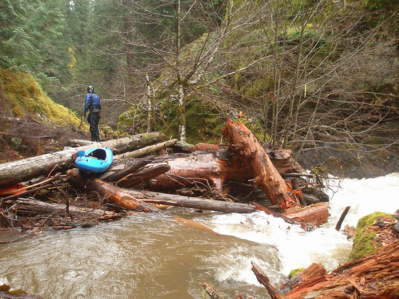
Pete figuring out the way around another heinous log-choked drop. Things were beginning to deteriorate at this point as the complex portages burned through big chunks of our precious daylight. This portage involved some caving on creek-left under the huge moss-covered boulder pictured here.
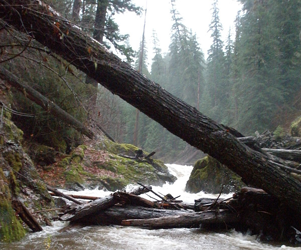
There was one last big rapid on Pyramid, a narrow pinch dropping about ten feet that was probably runnable at lower water but at high flows was a complete nightmare. Once again the high water made portaging this drop a difficult and dangerous experience. James slipped and almost fell in, and the ferry out of the log-filled, boiling pool backed up by logs downstream of the drop was completely terrifying. We were very glad to put that drop behind us.
Possibly the most dangerous and scary portage of the day. We portaged on the creek-right, then were forced into an extremely difficult and dangerous ferry above the log-sieve exit of the drop pictured here to reach the exit on creek-left. The pool below the drop was chaotic with huge boils and water surging downstream through the log sieve. This portage is the number one reason why no one should run this creek at high water.
Soon the creek opened up as Pyramid poured into the Middle Santiam river valley. We all whooped and cheered, happy to be able to see a hundred yards downstream at a time without a log in sight.
Our elation was soon tempered by the sight of another large logjam in the distance, but there were no vertical walls rising up around it so we were oddly pleased at how 'easy' it was to portage this one..
'Easy' portaging over a huge logjam near the end of the run. We had now entered the Middle Santiam river valley, much to our relief.
Once downstream of the last big logjam we made good time. The light was failing and we moved as fast as we could. It was now that we realized how high the water was, the Middle Santiam was up in the trees, big and muddy. We rolled along for about ten minutes before James finally hit an eddy and said: Does anyone know where the take out is?!?"
Now that's the kind of thing that gets everyones attention. Blank stares all around. Ummm.. I think everyone thought everyone else had figured that one out.
As we stood on a gravel bar island trying to figure out what to do, we heard a faint yell came out of the darkness from the other side of the river. James immediately ferried across, hoping that it was his friend Ken who was supposed to pick us up at the end of the run.
Ummmm.. where do we take out?
The problem is, none of us knew exactly where the end of the run was supposed to be. According to James his friend Ken was supposed to meet us at a primitive campsite by the edge of the river, but it was getting dark and the wall of trees on river left were shrouded in darkness. James returned a short while later saying that he hadn't made contact with Ken, but he was reasonably sure that had been Ken yelling at us and that we should continue downstream.
Our main concern was missing the primitive campsite rendezvous in the dark, because downstream of the meeting place was twenty miles of wilderness before the Middle Santiam emptied into a reservoir. None of us were especially stoked about doing the Wilderness section of the Middle after our day on Pyramid, so we moved downstream slowly, sweeping the riverbank constantly with our headlamps.
Finally it got too dark to paddle and we took out on the left where the river bank appeared to be easy to climb. We chose well, because we were actually on the north side of the take out campground, which meant a short trip through the woods put us on the trail that would take us out of the canyon.
We slogged through the woods in the dark with our headlamps on until we heard a dog bark, which was a welcome sound. Ken soon came into view, sheathed in rain gear from head to toe and grinning from ear to ear. We were fired up to get out of the canyon so we followed Ken up the trail without a break. After a half hour or so of climbing we reached the truck, loaded our gear, and settled down for the long but wonderfully warm ride back to our car.
Mike Long later made the following observation about our experience on Pyramid Creek: "It is tough to elaborate enough on the stress of running this particular
creek at high water. It was four and a half miles of unknown, cliffed-in in gorges, short daylight,
sketchy eddy situations. The twisty nature of the run and the rain/mist limited visibility,
there was no real chance of hiking out, and the gradient was steep
enough that you couldn't see the bottom of the next drop in most places.
I'm surprised we made it out when we did. Most
important was the concept of "must get out before dark".
For me this contributed to redefining "last chance eddy." I probably
wouldn't have probed with that limited beta when I ended up getting trapped if the objective hadn't
been to drive.. Lesson learned.
I think overall we did really well. Worked well as a team when the $#!T
hit the fan, kept our heads, portaged pretty quickly, communicated well
using limited hand signals, and left ourselves with options."
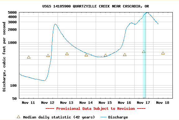
Pyramid flows into the Wilderness run on the Middle Santiam, so there is no gauge. Because Upper Quartzville and Pyramid are in the same general area, closest gauge to Pyramid is probably Quartzville. A sketchy correlation based on our one experience would be that Pyramid has one quarter of the flow in Quartzville Creek, because we had about a thousand cfs in Pyramid creek when Quartzville was in the range shown below. I suspect a more manageable flow for Pyramid would be about 2,500 cfs on the quartzville gauge, which would be about 600 cfs in Pyramid.
The vertical blue bar shows the flows in the Quartzville gauge during the time we were on Pyramid Creek.
If you decide to try and repeat Pyramid, you have your work cut out for you. Good luck and don't forget your log repellent.
Pyramid Creek flows through the fog-shrouded canyon visible far below in the middle of this photo.

Looking back uphill at our descent route.
We put on the creek and headed downstream. There were a couple of short log portages and no significant whitewater. It was still pouring and the creek was a little muddy, so we were starting have concerns about high water. These concerns were justified when we finally arrived at the Scar Creek confluence.
The entire right wall of Pyramid was blown out by Scar Creek, you can see some of the erosion downstream on the right side.


This huge boulder garden continues as far as they eye can see downstream, and then another fifty yards around the corner..
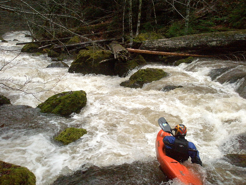
The upper half of the entrance is not pictured here. This is the same boof James is pictured hitting in the photo above.
Again, we couldn't scout beyond the spot where this photo was taken, so it was fire off the probe unit and hope for the best..


Attempting to answer that somewhat important question as darkness falls..