California, Salmon River drainage
Class V, Gradient: 400-800 fpm, Pool-drop
Click here to watch the video
trip report for this creek.

A three-mile Marathon, by James Bagley Jr.
California, Salmon River drainage
Click here to watch the video
trip report for this creek.
Class V, Gradient: 400-800 fpm, Pool-drop
Heard of it? Wanna try it? This report will attempt to inform you of what you are in for on a run down Bridge Creek, California.
Your day on Bridge Creek will start with a 20 mile shuttle ride over unimproved dirt roads where you ascend up to 4000 feet. Then you will be faced with a 2 mile "hike" (mostly, it's a sliding and falling experience) where you descend to 2,800 feet. Hopefully, you can do all this before 11 a.m. because it will take every minute of available daylight to complete your Bridge Creek adventure.
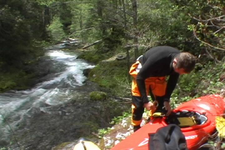
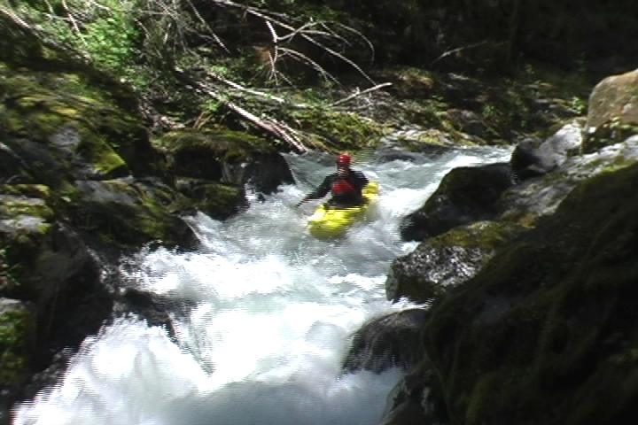
Jesse Coombs getting
ready to put on after an exhausting hike. The first thing you notice about Bridge Creek, looking upstream, is that it's
really steep. The next thing you notice about the creek, looking downstream, is
that it gets steeper. The last, and probably most important, thing you notice is
that there is wood everywhere. Jesse finishes one
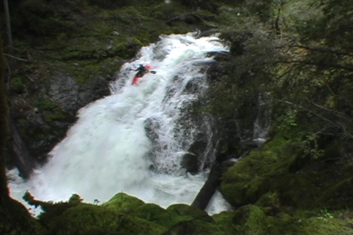
of many portages in the 'Manky Mile'. 'The Shit' begins with a very obvious and notable increase in gradient as the
creek steepens to something like 400 fpm. Your first real challenging drop is a
long, narrow slide with an 8' falls where you narrowly avoid faceplanting a very
large pair of trees approaching at 100 mph.
Be sure to catch the very first
possible eddy because there's a waterfall just downstream, and after that some
slides and another waterfall. This is all in the first 1/4 mile of "The Shit".
Really good stuff, but you want to be on your game. Eddy's are small and things
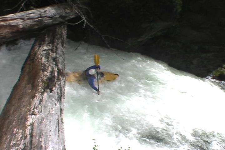
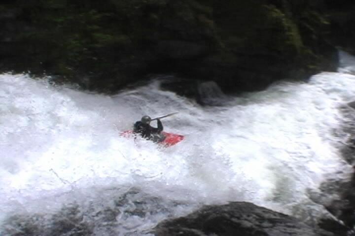
happen pretty fast. Judd below the logs
on the first drop and boofing the waterfall. Judd, being the only one who had done the run, was providing Jesse some beta
in a two boat eddy above a serious horizon line for two solid minutes. Then, Judd
eddied out and disappeared.
I joined Jesse in the two-boat eddy and asked the
obvious question "What's the beta?". Jesse replied: "Stay right." I gave him an
odd a look as I could manage and peeled out, staying as far right as seemed
appropriate... In the interest of saving time, we ran quite a few drops this way
with varying degrees of success. The author runs a
slide. I remember thinking at some point: "How could anything be any steeper than
this?!?"
Then it happened.
We arrived at the final mile which drops at something
absurd like 800 fpm.
Not only is the creek steeper, but it gets less
continuous. This can mean only one thing, BIG drops, and all of them very
runnable. Jesse and I made two portages in this section. One simply because we
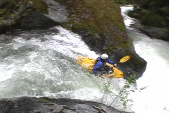
were tired and another because of a scary hydraulic called penalty box. Chris Khorbulic runs
a typical drop on Bridge Creek (taken on a later trip) Ben Stookesberry runs
Magnetic falls (taken on a later trip) At the final falls we heaved a big sigh of relief, it was over, which was
nice until Judd mentioned that we have 8 more miles of Wooly Creek to paddle and
it was nearly 5 p.m.
Wooly Creek is completely different from Bridge Creek. This
is a big water class IV+ run that is easily as difficult as the popular
Cal-Salmon Nordheimer run. Oddly enough, Bridge Creek is best when Wooly is
pretty high. There are a lot of really big holes on Wooly and each of us got
worked over at some point. In hindsight, some of the rapids on Wooly deserve a
brief scout. When a large tributary came in on river left signifying the takeout we heaved
another big sight of relief, it was really finally over, which was nice until
Judd mentioned we had to ascend 200' to the road... Anyone that said Bridge Creek was 'easy' was LYING to you. Although, my
understanding is that most people run it at lower water, which would make the
drops a bit easier. It's still a long and physically demanding trip. The fact
that Judd has a 60% success rate of completing the run in a day might persuade
you to believe that EASY is not an accurate description. Flows: Access: The takeout: The putin: Your hike will take you 1.2 miles down an old poor excuse for a road. Then
you will find a newly created poor excuse for a trail on your left. Fall down
this for another mile or so to the creek. If the trail seems to meander in
unexpected directions and then disappear, you are lost. Retrace your footsteps
and try to find the real "trail". I'm told that getting down to the creek
anywhere except on the "trail" is not much fun. Additional note from the authors second journey: FYI, Bridge Creek
is intimidating enough without swimming the first big drop so I highly recommend
scouting this one. The rest of the day went fine, and we actually completed the
run in record time (about 4 hours from putting on bridge to taking out of
wooly). But, it was a bit stressful...
The first mile drops at roughly 200 fpm
and is lovingly referred to as "the manky mile". I do not recall exactly how many
pins, broaches, or portages were involved in descending through "the manky
mile", but it must be done to get to "the shit" (the second mile). 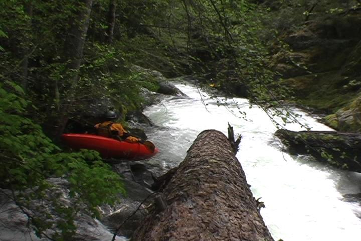
Bridge Creek beta - flows and access
Estimating what the flow might be on Bridge Creek is total
guesswork at best. It has been known to be runnable at between 4' and 7' on the
Cal-Salmon gauge. A better tell-tale is to look at the confluence of Wooly Kr
and the Salmon for a gravel bar. If the gravel bar is almost, but not quite,
completely covered then go for it; flows should be medium-high. If there is no
sign of the gravel bar whatsoever and you put-on anyways, then I have a letter
for you to sign from a Mr. Will-and-Testament. As for how low Bridge Creek is
runnable, I'll leave that exercise up to the ELF (extreme low flow) boaters.
Finding Bridge Creek on a map is pretty simple. Just follow
Wooly Cr up from the Salmon until Bridge Cr comes in on the north side. Actually
getting there is trickier.
You can set shuttle on the Salmon at Wooly Cr trail
head (to avoid the 200' climb out of Wooly) or you can cross the bridge at the
confluence and park near the end of the road. Realistically, anywhere you can
get to the river around the confluence of Wooly will work as long as it isn't
upstream on the Salmon.
Head downstream from the Salmon-Wooly confluence and
turn right on camp 3 road. This road turns to dirt at some point. Just follow
signs that say camp 3 and wilderness trails. Also look for signs to Leter Buck
trail head, this means you are still going the right way. When you cross
Haypress Creek (not runnable) you are getting close. The road will end somewhere
near Leter Buck trail head and your hike begins on an old road that goes off to
your right (south?). This is all based on observations made from under a canopy
in the back of a pickup while failing to find anything solid to hang on to other
than Harvey (Judd's friendly but smelly dog). Meaning, THIS INFORMATION MAY NOT
BE ACCURATE so bring a map. Or, even better, bring someone that's done it
before.