Nico Zegre suits up for the long hike in.
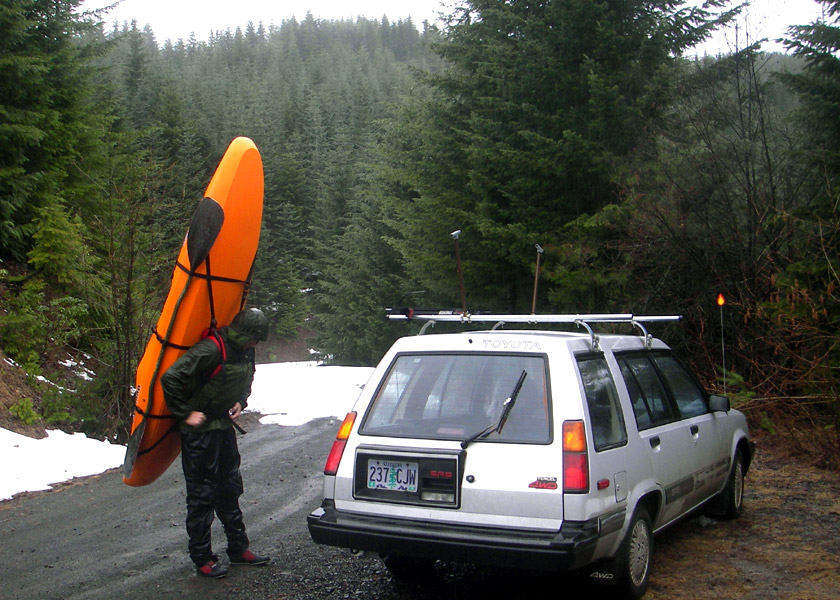
Well, we parked somewhere around milepost seven and set off up the road,
dragging our boats loaded with overnight gear. A
couple miles later the snow ended and the boats went
onto our backs.
Nick only had rodeo socks for the hike, I
had cobbled together a pack with NRS straps and a life jacket, and Jeff has a vertebral problem that
generally isn't made better by carrying heavy things
around. The way I figured it, if you combined the three of us together we
had maybe one well-prepared kayaker.
A little while after running out of snow we also ran out of mileposts..
maybe around 12.5 or 13, I threw down my boat. None
of the roads had signs anymore, and we were worried
when we turned off on a trail ( one I thought I
remembered from the map ) that the road we should
really be taking was the one we'd left behind.
We had no map of course.
Sigh.
It seemed that we'd underestimated the distance to the
river, but the description in the guidebook didn't
seem to fit with the turn we'd taken to get to the
water. The road we thought we should have stayed on
obviously continued to climb away from the valley and
the river. So, we decided to climb down into what appeared
to be a river valley below us.
Our decision to descend could be summed up as: "We'll get to the water somehow.. We know it's
down there, right?"
We followed a hiking trail and reached the river as
darkness set in. Hoping for at least a decent campsite,
we paddled half a mile and camped on a comfortable
flat shelf, completely unsure of where we were.
After a half-hearted attempt to start a fire, we let it sputter out
and sat in darkness on an upturned boat under a tarp, the rain still falling..
The next morning started with a lively debate as to
where we actually were. The channel was wide and
cobbled, spanned in a few places by huge trees. As we proceeded downstream
the river narrowed and the rapids became continuous and
gradually more difficult.
After at least five miles
we hit our first bridge over the river, putting us at
least within the intended stretch of river, but we
hadn't seen Pyramid Creek, which was one of our major
landmarks. If we'd put in upstream as far as South
Pyramid Creek, which is a much smaller tributary, we
might have as much as twenty-five miles to paddle that
day. We debated, but we never stopped paddling..
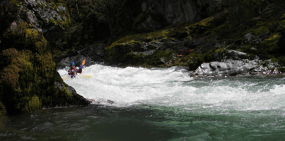
All things considered, the whitewater slipped by fast.
All of the rapids on this section are stacked close
together, with maybe a fifty yards of slackwater
between them. Most of the drops were long boulder gardens with the
occasional big gaping hole, or a ledge that would crop up when you
realize that you have been holding your breath
maneuvering your heavy creekboat down a
quarter-mile long rapid.. Then you breathe, look at the
scenery, look downstream and start picking lines
again..
We didn't get very many photos while we were on the river.. we were having too much fun!
Here and there we stopped to guzzle water and snack,
but we were pushing downriver fast to get to the
reservoir. Suddenly the continuous boogie-water
slackened, and we had run our last drop. The
reservoir pushed back with a headwind, glaring
sunlight, and ugly stumps.
The author on the six-mile flat water paddle out of the Middle Fork
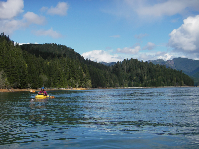
We paddled under the
Weyerhauser bridge and sighed.
A motorboat tooled by
and we sighed again.
Six miles later we pulled up at
the boat launch. Nick stumbled away up to his car and
drove it a hundred yards down to the boat ramp.
We lifted the boats in pairs, one person on each end,
tenderly. On our way to burgers and fries we studied
the map intently. The path we took to the river might
be the one on the map, might even be the one the
guidebook intended with its vague description. But
carrying one's boat and gear six miles in the pouring
rain and then paddling twenty something miles the next
day...
I don't know... I still just don't know. After
pulling up 2005 aerial photographs and 1:24000 topo
maps at work, I still don't know where we put in. I
don't know how far I paddled or carried my boat on my first kayak overnighter,
but that's how it goes sometimes I guess..

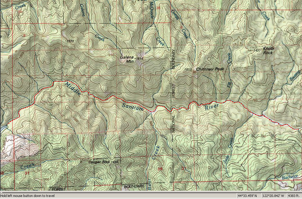
The entire Middle Santiam wilderness run, starting at Pyramid Creek on the right side of the image and ending with the reservoir on the left.
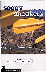
For directions to the put-in and take-out, as well as other info, pick up the newest edition of the Oregon paddling bible, 'Soggy Sneakers' by Pete Giordano and the WKCC. This is a book no serious Northwest paddler should be without. You can pick this book up at your local paddling shop, or on amazon.com.