
The South Fork Skokomish has some great whitewater, but only the most adventurous paddlers will enjoy this river.
This run is located on the Southeast side of Washington's Olympic Peninsula, and the river has a remote, wild feeling akin to the Grand Canyon of the Elwha. All of the whitewater on this eleven-mile section is located in the two middle gorges, so paddlers face a paddle in of about 2 miles and a paddle out of about 3 miles, all of which is on fast-moving class II water. That said, the scenery is excellent for the most part, so the mellow stuff at the beginning and the end goes by pretty quick.
We ran the South Fork for the first time in the Winter of 2002, when everything in Oregon was bone-dry and the Olympics were the only game in town. The previous week had seen a significant rain event in Washington, and all of the Olympic rivers were dropping down from season-high levels during the previous week.
On this trip Pete Giordano and I were accompanied by two accomplished German Paddlers, Jurgen Nickles and Tom Baudisch. Jurgen and Tom had flown in from Germany for a week of boating, so we scoured the Northwest for rivers and creeks with water before we came up with the SF Sko..
None of us had done the river before, so we were pretty excited. The only beta we had on the run was the Korb guidebook description (over ten years old) and the fact that one of the best paddlers I know almost drowned on this river when he got sucked into a boulder sieve.
Nevertheless, we were stoked, and after a hearty breakfast of Powerbars and Coconut Cream Pie we cruised up to the put-in. The road down to the river was easy to find (the message-board in the Korb guidebook is still there) but the road was gated, forcing a half-mile downhill hike to the river. As I mentioned before, the South Fork starts off easy and kind of stays that way for a few miles. We floated lazily around a few logs, soaking up the scenery and joked about how long it had been since we had seen this much water (we had about 800 cfs on the SF Skokomish at Union internet gauge).
Finally the rock walls started creeping out of the water and the river took a sharp turn to the right and dropped out of sight. We scouted on the left, and found a fun-looking class IV drop with a boof on the far right followed by a scramble past a pile of boulders in the center. No one had any problems here, but it should be noted that the middle chute on this drop appeared to have a submerged boulder in it.
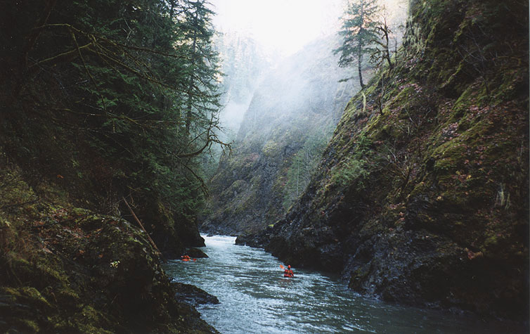
Now we were in the first gorge, and it was impressive, the mossy rock walls soaring hundreds of feet overhead, leaving no way out but down, which seems to be a common theme on the Olympic rivers I have paddled.
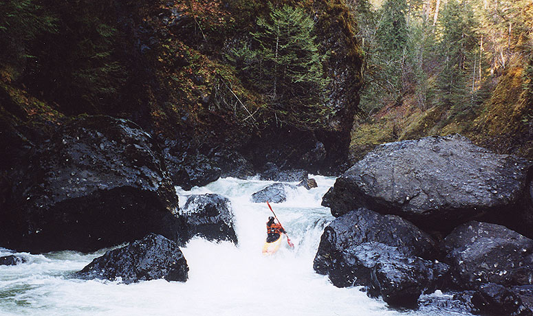
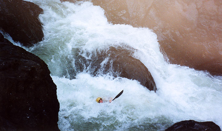
After a few smaller drops we arrived at a significant horizon line, and got out to scout on the left. What we saw looked good, and Jurgen probed the rapid without problems. Pete went next, flipped in the first drop (a deceptively tricky curler) and everyone got pretty excited but he snapped off a quick roll and ran the bottom two drops without problems. After that Tom and I scouted the lead-in carefully to be sure we didn't repeat Pete's excessively exciting line, and we had no problems. (This drop is referred to as 'Big Momma Jomba' in the Korb guidebook.) I went for the gut in the final drop and did a meltdown move into the pool below, very fun!
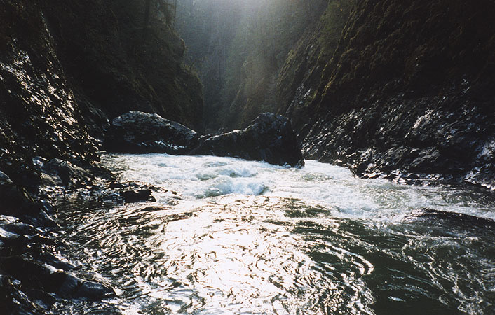
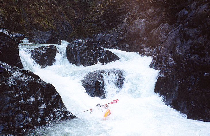
The first couple of rapids in the second gorge were relatively easy, and then the walls started to rise out of the water and we ran out of scouting options. Below us the river rushed down between steep rock walls into two huge boulders that blocked most of the flow. There were blind chutes on either side of the boulders, neither of which was scoutable. We could hear an alarmingly loud roar downstream, so we knew there was something big on the other side of the boulders..
Just downstream was a large boulder garden that we ran down the left, then we piled up in an eddy above the next horizon line, which appeared to be a blind, unscoutable ledge. Well, there was only one way to figure this one out, so Tom looked at me and said "I go!" and ran it right down the middle. After a moment he emerged in the pool below looking unconcerned, so we all followed suit..
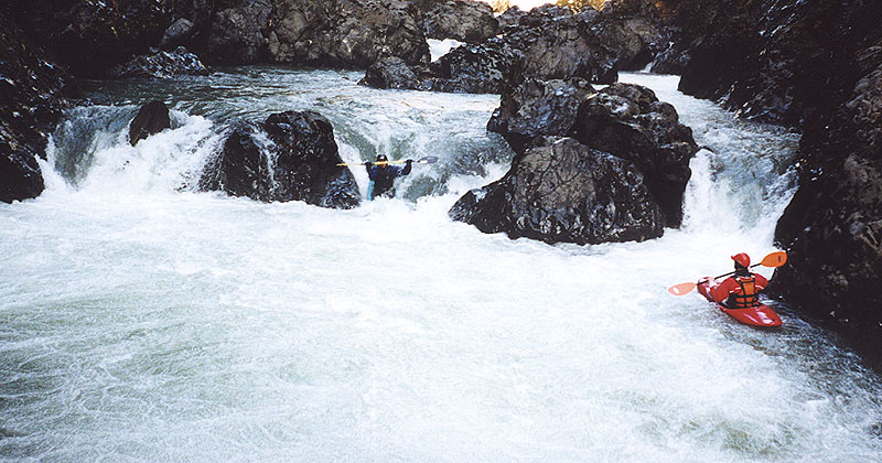
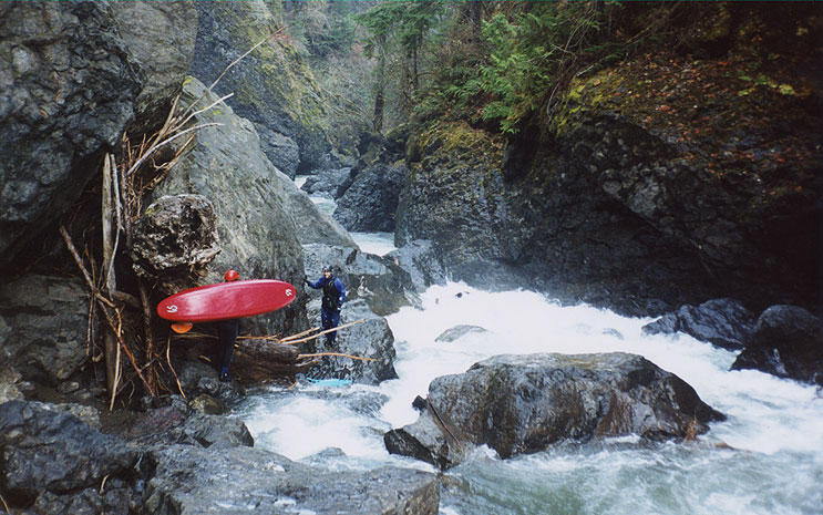
When we arrived at the drop (known as 'High Steel Falls') I got out to scout and just managed to take a photo of the last member of the group in front of us as he blasted through this beefy double drop..
Below Mr. Toad's the river mellowed to class II again for the final three miles, though after we arrived at the take we all agreed it wasn't a matter of 'if' we were going to return to the South Fork, but 'when'...
The Korb guidebook recommends that you avoid this section at high water, and I would agree with that assessment. There is no way out of the second gorge once you run the first drop except down the river, and at high water all portaging/scouting/safety options would evaporate and paddlers would be faced with a formidable and unavoidable series of V to V+ drops with horrendous holes (I can only imagine).
The photos taken on this site show the river at 800 cfs gradually dropping to 700 on the SF Sko internet gauge. This is a good flow, because the easy stuff at the beginning and end isn't too annoying and the drops in the gorge are pretty manageable. I think 1200 or so would be a nice healthy medium flow, but anything higher would get pretty exciting.
The paddler later told me that came out of his boat as he was sucked under and was forcibly pinned on his back against a boulder in the sieve, with the water coming down with such force that he couldn't move. Luckily the water was surging periodically so he was able to time it so when the flow abated temporarily he twisted and dove down deeper, going with the flow and miraculously squeezing though a slot under the boulder! Almost a minute later he emerged downstream, much to the relief of Gabe and the others, who thought he was gone for good!
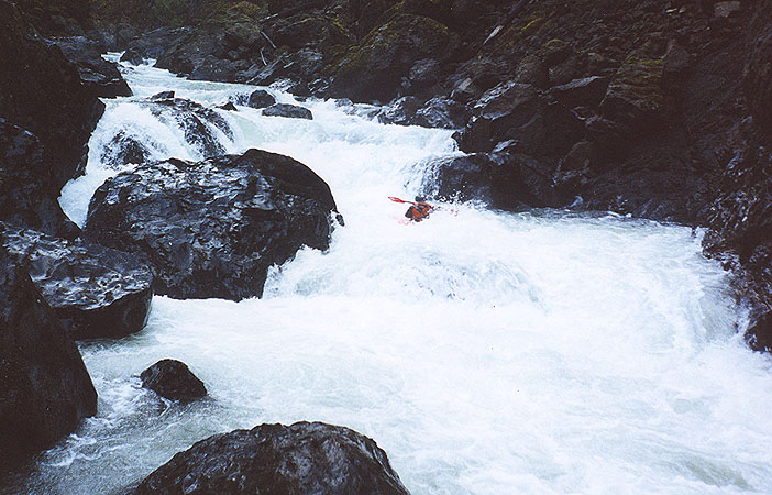
This drop is the boulder garden immediately above High Steel Falls. It is easy to scout or portage this drop on the right side, so you can make the call when you get there.