The North Fork of the Yuba ( Sierra City to Downieville )

Copyright © 2003, Oregon Kayaking.
No part of this page may be reproduced, linked, or copied without the
express written
permission of the Oregon Kayaking Webmaster.
In April 2003 we took our annual California Spring Break trip,
which ended
up spanning five major river basins: The American, The Yuba, The
Sacramento, The Trinity, and the Salmon.
We paddled a wide variety of
rivers and creeks, met some great folks, and had a great time. At the end
of the trip we had: Two broken boats, one broken paddle, and two swims out
of burly hydraulics.
This time around I was accompanied by: Pete
Giordano (Portland), Dan 'The Man' Coyle (Corvallis), Josh Knapp and Gabe
Flock (Eugene).
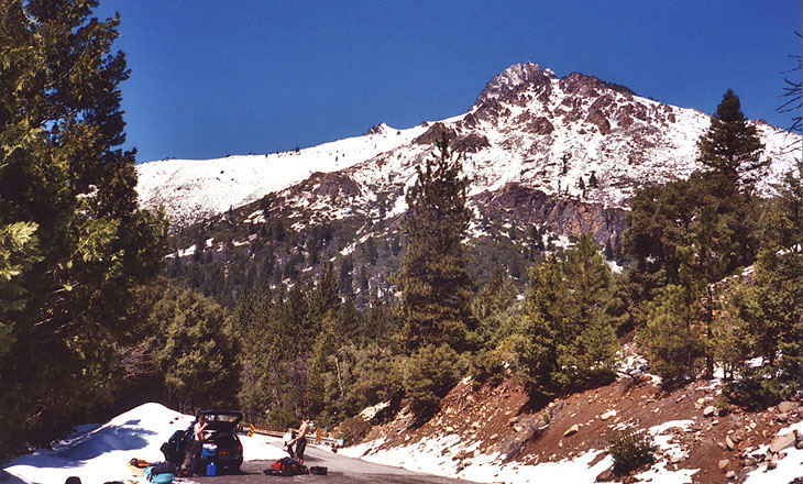
The North Fork of the Yuba played a major role in the legendary California Gold Rush of the 1800's. This river has many miles of great whitewater (four different runs), but I found the historic monuments as interesting as the river itself; this would be a great spot to take a rest day and do some hiking or sightseeing.
We put in at Sierra City, a charming, rustic little village on the banks of the North Fork. This city was founded in 1850 as a rough-and-tumble mining town but in the winter of 1853 much of the town was destroyed by an avalanche. Needless to say, the town was rebuilt and today this sleepy little village is a popular outdoors destination.
The town of Downieville at the take-out reminded me of some of the older, smaller towns in Germany, with narrow, winding streets perched precariously above the various rivers that converge upon the site. To put things in perspective, by the late 1850's Downieville was the fifth largest city in California! Both of these towns are fascinating snapshots of the old west, and they nicely complement a great day of boating on the North Fork.
The Sierra City section of the North Fork is actually broken down into three distinct canyons. The upper has Ladies Canyon, which is followed by Moss Canyon and then Rosassco Canyon. We took out above above Rosassco because Josh had run it the day before we came down and it would have made for a bit of a long day if we had linked all three.
Gabe Flock and Josh Knapp get ready at the put in for the Sierra City section.
 Gabe cruises downstream below the put-in.
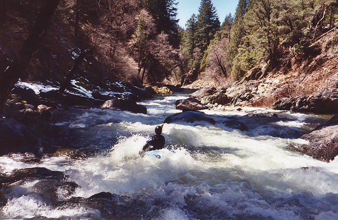 Gabe, hole-bashing on the North Fork...
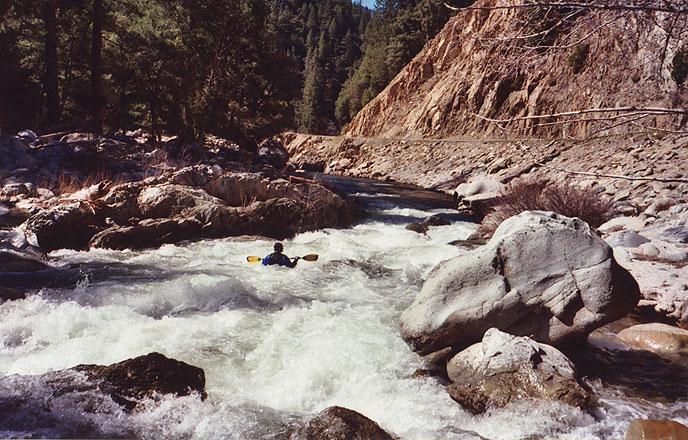
 Pete Giordano dodges some big holes in a typical rapid...
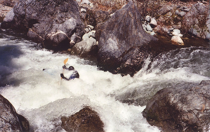
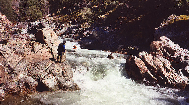
 The toughest drop on this run is located in 'Ladies Canyon', a short section of the river named for nearby Ladies Canyon Creek. The final drop in Ladies Canyon powers through two holes, the bottom of which has a rock backing up the hydraulic. This rock helps form the 'Murderous Hole' described in the Stanley/Holbeck guidebook, and if you look carefully in the photo below you can see part of the rock poking up through the foam on the river-right side of the drop..
Only Josh wanted to challenge the holes on this day, so while Pete stood by with a rope he came charging down. The top hole is pretty significant in it's own right, and when Josh punched it he surfaced in the middle of the river. As we looked on, he shook it off, lined up, and tore downstream, churning up an impressive wake. He hit the bottom hole on the river-right side with a little left angle and popped through, no problem!
"Wow." Pete said with a grin after it was all over. "I think that's the hardest I've ever seen Josh paddle.."
Josh Knapp charges downstream towards the 'murderous hole' in the crux drop in Ladies Canyon...
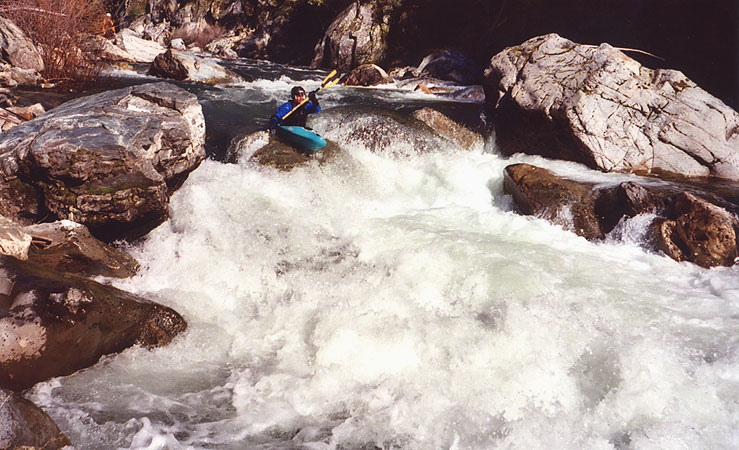
 Below Ladies Canyon the river had more interesting rapids, culminating in Moss Canyon, which has a few meaty drops to spice up the end of the day..
Pete enters a fun rapid in Moss Canyon
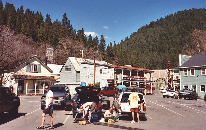
 Below Moss Canyon the river mellowed to the take-out at Downieville. After taking out we relaxed in the town square, ate lunch, and enjoyed the sun. We had already decided to paddle the South Fork of the Yuba the next day, which proved to be one of the highlights of the trip..
A post-paddling lunch. From the left, Josh, Gabe, Dan and Pete soak up some well-deserved sun in Downieville..
 The NF ..WHAT?
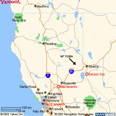
Many of you may be wondering where this river is located. The North Fork
of the
Yuba flows through the wild and rugged Tahoe National Forest. It is
about a 9 hour drive from Portland, depending on how good your radar
detector is.
We drove down I5 and then turned east on Highway 20, (where the 'I5'
symbol is on the map) and headed east up to the river from there..
The NF of the Yuba's approximate location, courtesy of 'Yahoo.'