
By Chris Arnold
Class: IV-V+
Distance: 32 miles
Location: California - Northern Sierra Nevada
Season: Spring snow melt May - July
Gradient: 75 ft/mile (Cassady & Calhoun)
Flow: 1250-1120cfs ( gauge apparently reading 200-400 cfs low )
Date: May 22-24, 2009
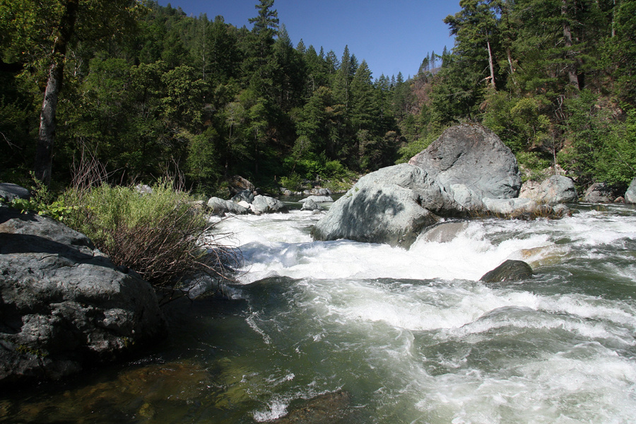
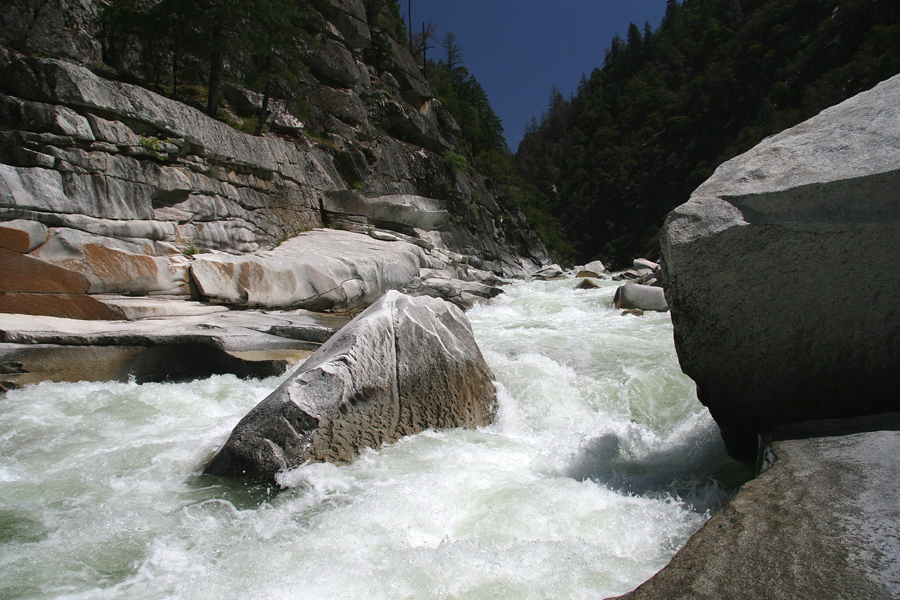
Character: 32 miles of big drops and long boulder gardens generally separated by sections of swift water with a few mandatory portages (by most) located in a deep remote canyon.
I rolled into Eugene around noon on Thursday, May 21st. I picked up Jason and we headed to Nate's place a few miles on the other side of town. By 1:30 we were headed to Roseburg to grab Shawn, our last paddler. Five hours later we found ourselves in Chico, California at the Sierra Nevada Brewery.
After a great meal we camped just outside of Oroville at Loafer Creek Campground. Jason and Nate had planned the majority of the trip and handled all of the logistics including: renting a satellite phone ( highly recommended ), arranging our shuttle, researching the best camping spots on the river, and printing waterproof river maps. I was consumed with work the weeks before our trip but, the last thing I did before falling asleep was read the following description for the first time. Sweet dreams!
"The gorge of the Middle Fork Feather is the most spectacular and most difficult river in this book: 32 miles of class V and worse rapids in a remote, steep-walled canyon."
Jim Cassady and Fryar Calhoun,
California Whitewater 3rd Edition
Day One - Nelson point to Cleghorn Bar, approximately twelve miles
After a quick breakfast at a local establishment we rendezvoused with "Brush Creek Billy" one of Nate's oldest friends and former frat brother. He was kind enough to run the 125-mile one-way shuttle for us.
The first day started off with a few miles of relatively calm water and one mandatory log portage before the action picked up. I got out to scout the first big class IV named "The Sieve", a small ledge drop accompanied by a moderate hole formed by nasty undercut boulder.
Jason running the first big class IV on the MF.
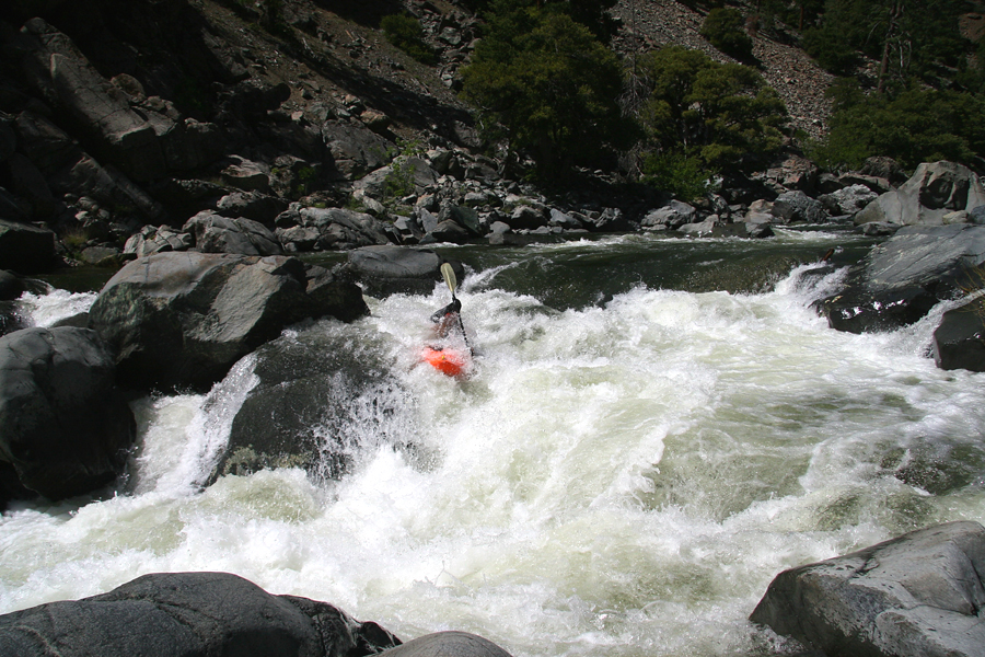
More class IV separated The Sieve from the first class V, named "Big One". We scouted from river left, and ran the river left side boofing the ledge at the bottom. Note: The picture doesn't do justice to the size of this drop. The lead-in consisted of about a hundred yards of steep class IV+.
A less-than-optimal shot of the final drop on the "Big One."
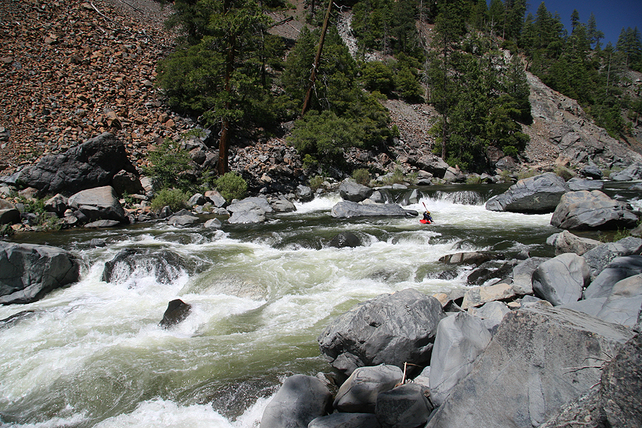
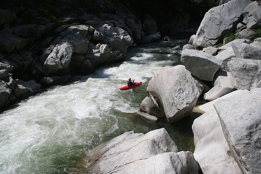
Below the first class V we encountered several long class IV-IV+ boulder gardens, most were easy to boat scout.
Nate at the top and in the middle of a typical boulder garden on Day One.
Photo: Jason Naranjo
The author runs a fun one downstream.
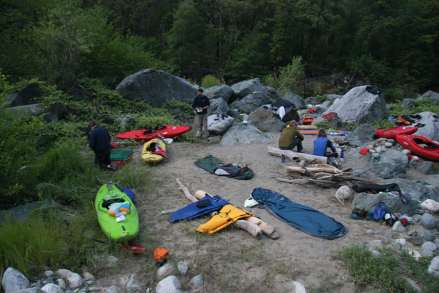
Day one ended in the vicinity of Cleghorn Bar. Our first camp was on the river right at the site of an 1860's mining operation. Deep in the brush we found a huge steam engine that was dated 1862. It was clear that this site was used extensively. There were the remnants of a stone foundation and lots of narrow gauge rail track and various pieces of steel strewn about.
Canyon Live Oak, Western Red Cedar, Big Leaf Maple, and Bay Myrtle ringed our camp. Windfall firewood was abundant. With his trusty machete Shawn made short work of some logs and we had a big-ol-fire by dark. Laughs and stories flowed in generous amounts before we turned in for the evening. We were all feeling mighty fine!
Day Two - Franklin Canyon, approximately fourteen miles
Day Two: Two beers lighter than day one.
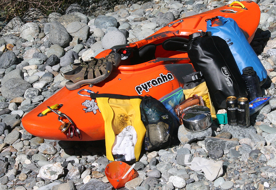
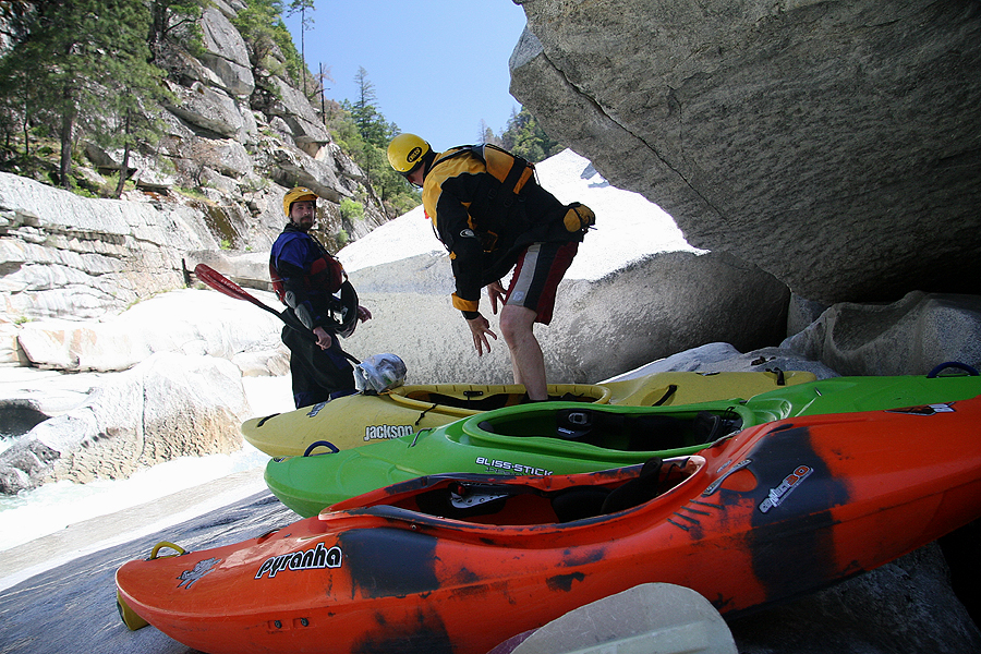
We put-on the river around 9:30 a.m. after reloading our kayaks. I must have had about fifty pounds of gear. Initially, I was concerned how my M Burn would perform fully loaded, but it was boofing, edging, and staying on top of the water like a champ.
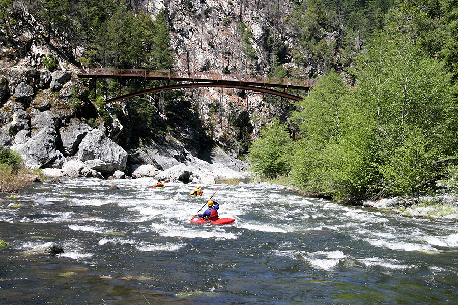
About an eighth of a mile into the day we heard Jason yelling: "BEAR!! BEAR IN THE WATER!! BEAR IN THE WATER!!" We rounded a corner in a relatively calm section and saw a large brown bear crossing the river. At first all that could be seen was his huge head rapidly moving across the river. Once he spotted us he made little work of a steep granite wall and headed up into the brush. After another eighth mile of river we were greeted by the Pacific Crest Trail Bridge, the entrance to Franklin Canyon.
The Pacific Crest Trail Bridge above the Middle Fork.
Franklin Falls lies about a quarter mile below the PCT Bridge. We scouted from river left and all opted to Nancy Reagan it. A good seal launch was found on river left below the base of the falls.
Below Franklin Falls we scouted a fun drop from river right. I opted for the left line and boofed over a hole, while Shawn took the right line.
The Author on the left, of the double drop.
Photo: Jason Naranjo
Shawn runs the right side of the double drop.
Photo: Jason Naranjo
A few miles below the drop pictured above drop two paddlers from Arcata, CA caught up to us. I recognized Paul from recent runs down the Cal Salmon and South Fork Smith. We quickly became a group of six with the addition of Paul and Ben.
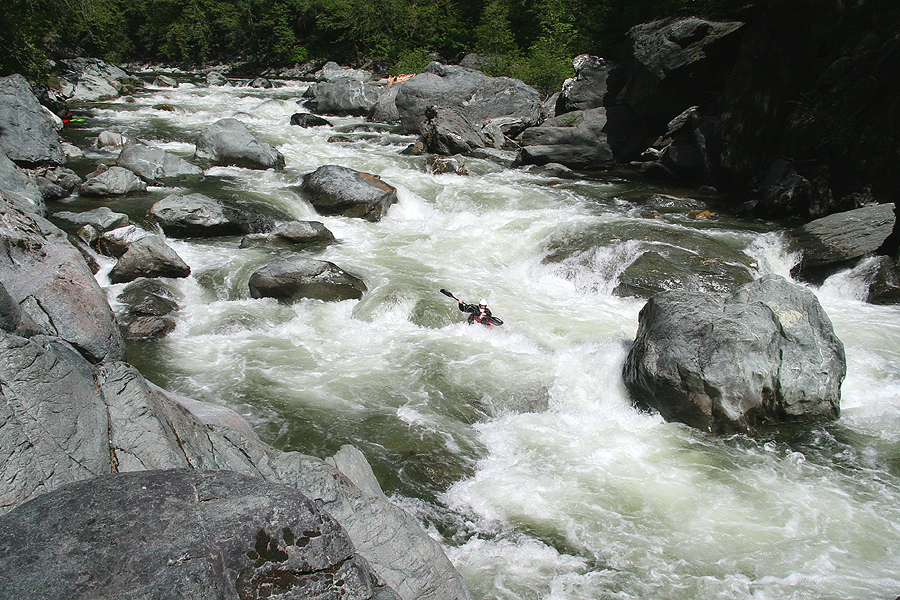
The action continued in Franklin Canyon for miles and miles! Ben, Shawn, and I took turns probing and scouting what we couldn't see from our kayaks.
Paul cleaning a great boulder garden.
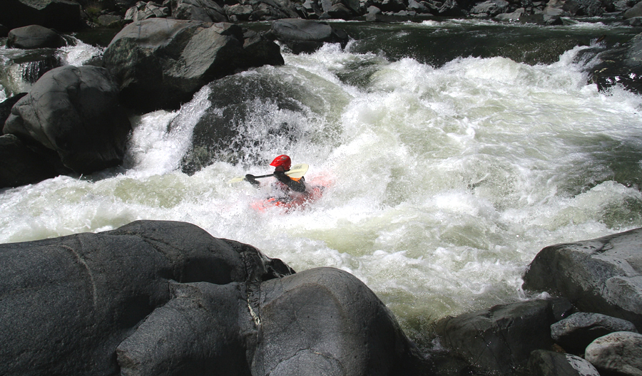
Nate running S-Turn, this one was SWEET!
The whitewater in Franklin Canyon was amazing. The rapids seemed to never stop coming, and by the end I was beat. Around this time we had one close call with an undercut. At this point I was pretty tired and when we arrived at a manky rapid I decided to portage it. I was in my kayak below the rapid pretty quick, while the rest of the group was getting ready to portage. All of a sudden I heard someone yell: "Hey Chris set safety." and I knew someone was going to run the drop. Unfortunately I was too far downstream to do anything but collect gear, but I did the best I could in the few moments I had.
Soon the three other paddlers on the river right bank started whistling and acting frantic and I knew something was wrong. Luckily the kayaker was able to pull himself from the undercut into a violent eddy just in front of it. From here he was able to scramble up the rock wall and seal lunch from the rock that created the undercut.
Day three ended at mile 25.75 around 7:30 p.m. near Kennedy Cabin ( ten hours of class IV-V ) on an island in the middle of the canyon.
Camp night two.
Again, fire wood was plentiful. After a long awaited meal Shawn wasted little time and soon had a great fire going with the aid of one match. I fell asleep under the stars adjacent to the fire on an island surrounded by class IV+ whitewater at the base of a deep canyon. That's living!
Day three started out fast with no real chance for a warm-up. This is the put-in for Day three, a class IV+ that surrounded or camp.
The bottom of the put-in drop on Day three.
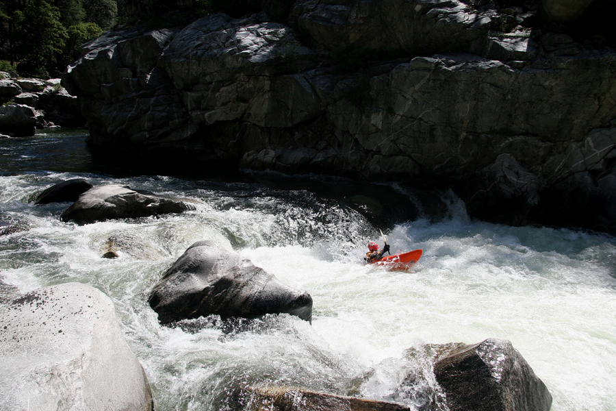
Soon after leaving camp the walls started to close in and we were well on our way into Devil's Canyon. "Eat The Meat" was the first big drop we encountered. This huge double drop looked UGLY. We all portaged on the left.
Below "Eat the Meat" we encountered more read-and-run class IV+ and soon came to an abrupt horizon line: a river-wide ledge with a big hole followed by another about seventy-five yards downstream. Both holes could be avoided by running hard right.
The Author boofing the top ledge.
Photos - Jason Naranjo
The Author below the ledge, at the middle crashing wave.
Photos: Jason Naranjo
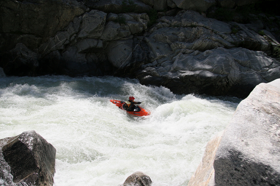
Nate at the bottom hole.
Abundant class IV rapids followed until the next BIG one. Shawn was the only one in our group that had paddled the Middle Fork before. On his previous trip an Olympic paddler, a local professional kayaker, and several other names you might recognize accompanied him. When he explained the professional boater had "problems" with the next drop we all decided it would be best to walk it.
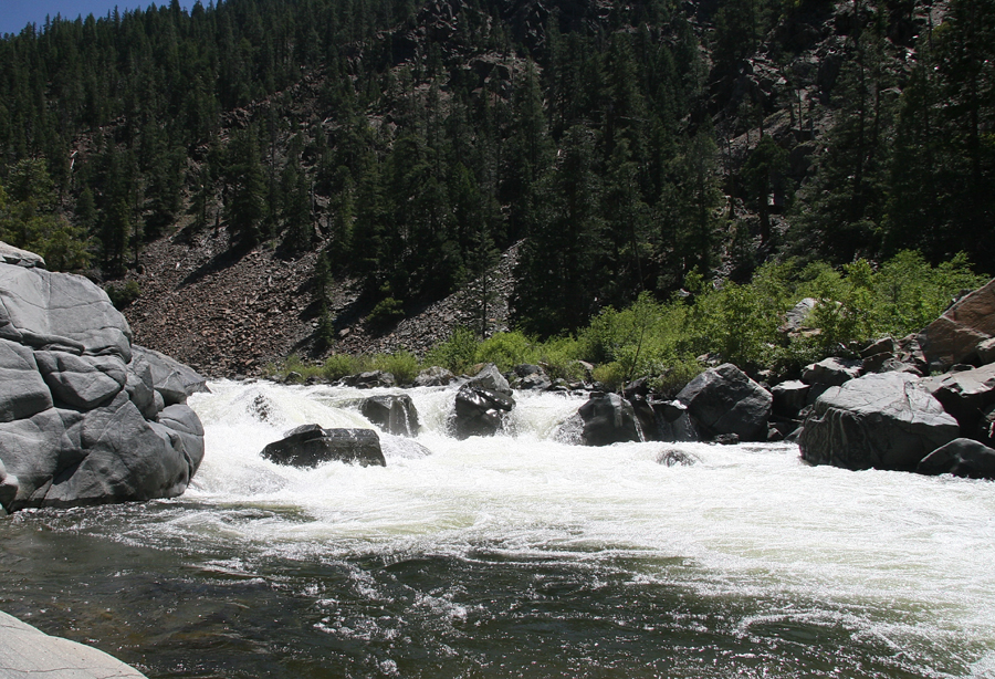
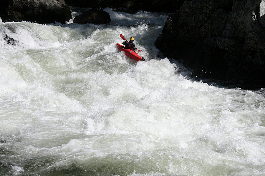
The entrance of a BIG class V+ on day three.
The bottom of the big drop on day three.
Shawn and the "Not-Professional-Kayakers" portaging the V+.
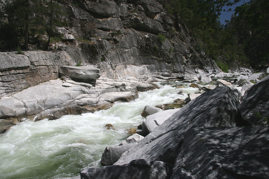
A large pool separates the above drop from the "Mandatory" portage in Devil's Canyon. We portaged on river left over a worn trail. There isn't much foot traffic in the canyon, but you wouldn't know it from this trail.
The "Mandatory" portage in Devil's Canyon.
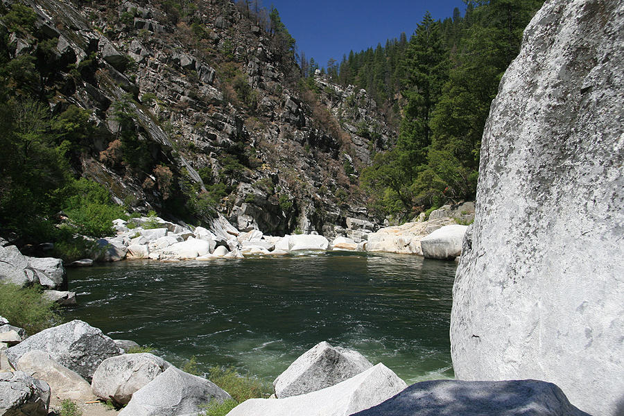
The bottom of the portage.
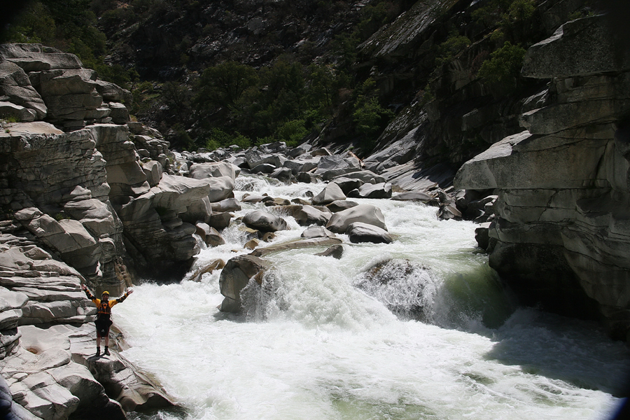
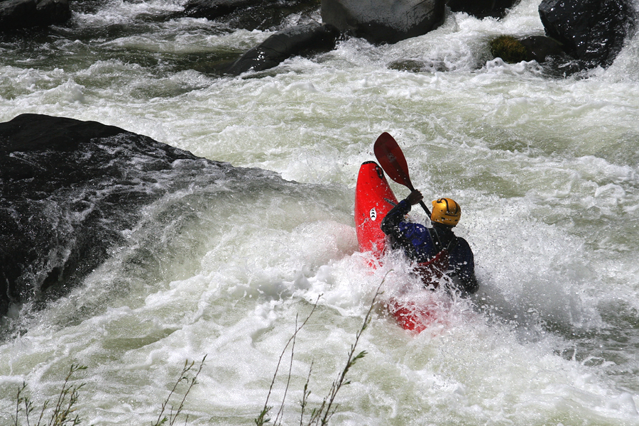
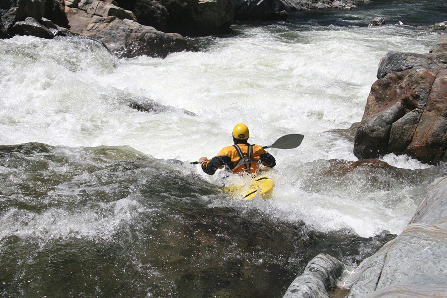
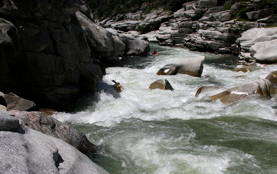
After recovering a nearly lost paddle, eating lunch, and refilling our water bottles we headed downstream. More outstanding class IV-IV+ rapids led up to "Helicopter" the only must-run class V of the trip.
Shawn in the middle of Helicopter.
This drop is unportageable and this is about as close as you can get before you have to run it.
Photo: Jason Naranjo
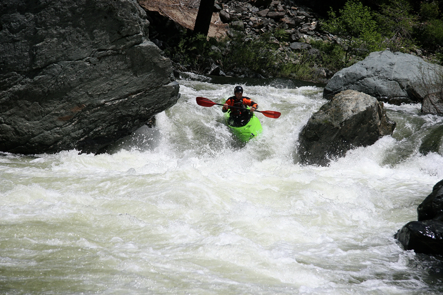
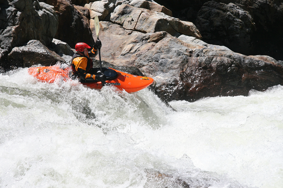
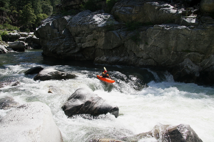
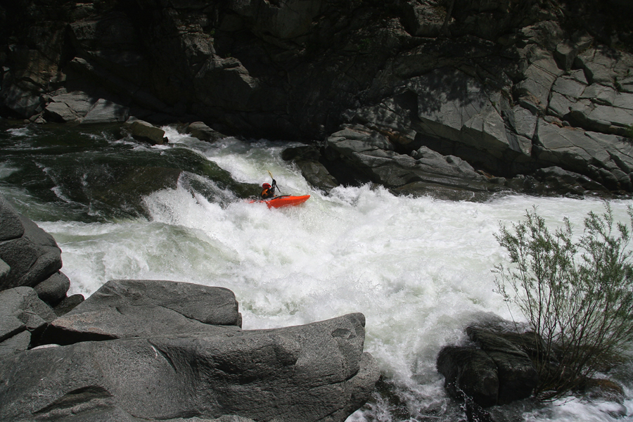
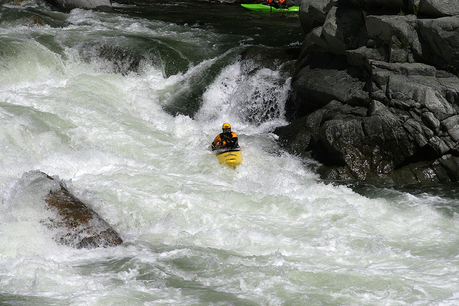
Several more class IV-IV+ rapids separated Helicopter from my favorite drop of the trip: a huge green tongue leading to a boof flake above a MASSIVE hole. Shawn and I looked at each other, smiled, and we both said center line! With safety set we both had good lines sailing over the big hole.
The Author hitting a boof on his favorite rapid of the trip.
Photo: Jason Naranjo
Shortly after the above rapid we found ourselves at Grand Finale. Jason and Shawn took the lead and ran the river left side while Nate and I took photos.
Shawn styling Grand Finale.
In the remaining mile below Grand Finale we encountered one or two more quality class IV rapids before the take-out bridge was in sight. After three days of world-class kayaking, scenery, and company, seeing the bridge was bittersweet. We made it, but the trip was nearly over.
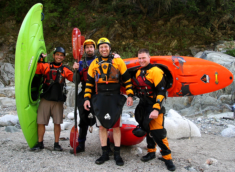
At the take-out we were greeted by several wide-eyed tourists, one of whom was kind enough to take the final shot of the trip.
From left to right: Jason, Nate, Shawn, and the Author.

The hydrograph below displays the recorded flows for our trip ( May 22-24 ), however, it was likely reading about 200-400 cfs low according to several posts on Dreamflows. This was confirmed by Shawn. On his previous trip Shawn had flows of approximately 1600 cfs, and according to him the river was at the same level.
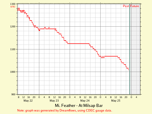
Editors note: Generally, 1,000 cfs is the minimum flow for hard shell kayaks. Generally speaking, 750 - 1,200 is low, 1,500 - 2,000 is medium. 2,500 and above is pushy but manageable. Around 3,000 the river really starts to push and starts to feel big. Of course, if the gauge is now reading low, add 200-400 cfs to all of the aforementioned gauge readings.
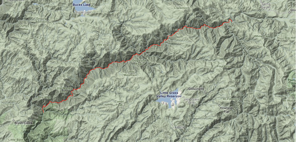
A zoomed-in map showing the Middle Fork Feather Devils Canyon.
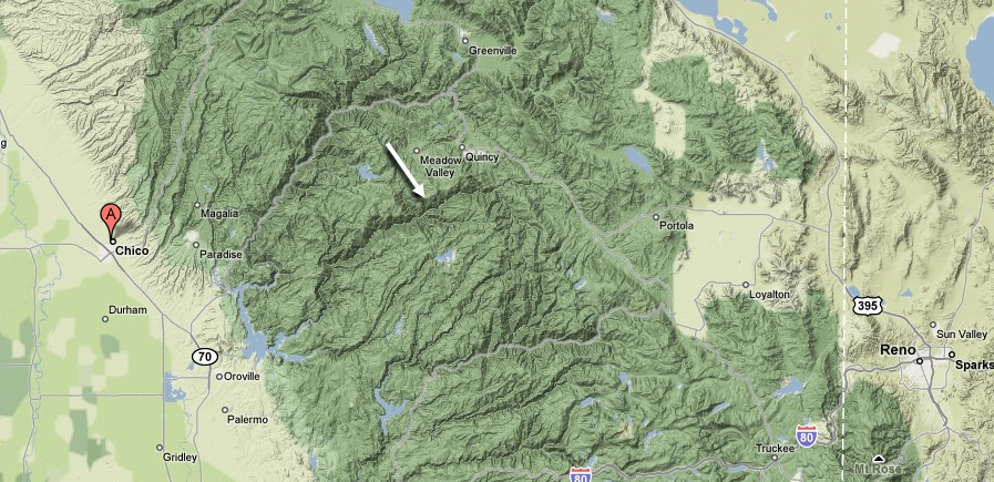
A zoomed-out map showing the Middle Fork Feather canyon. Chico is the closest major city on the California side.
For shuttle directions and complete info, pick up the Stanley / Holbeck guidebook, "The Best Whitewater in California." You can pick this book up at your local paddling shop, or on amazon.com.