By Austin Rathmann
Location: Wyoming, Wind River Indian Reservation
Length: Four Miles
Class: V
|
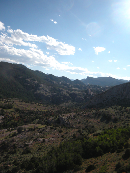
The North Fork of the Little Wind lies hidden between the sagebrush flats surrounding Lander, Wyoming and the 14,000 foot peaks of the central Wind River Mountains. In July of 2009 we ran the section that begins in the St. Lawrence Basin and drops down to the sagebrush flats at the foot of the Winds.
The North Fork of the Little Wind
This creek was found by a Wyoming kayaker named Brady J. over ten years ago. He had hiked the gorge several times and seen the waterfalls and knew it was well worth doing. However, the run is on the Wind River Indian Reservation so the creek was never run.
Evan Ross, John Souter and myself attempted to access the gorge from river-right off of a different road on several occasions, but we were shut down after getting lost or because we didn't have the required fishing permits you need to access the reservation. Finally, in 2009, after moving back to Wyoming, Brady and I got a group of four together and made the first descent of this amazing, beautiful, wilderness run. I can honestly say this run is better than B.C.'s Rogers Creek, and in my opinion this is one of the top five day runs in North America. To give you an idea of my list of such runs here it is..
Hiking to the put in.
The put in
Cruising downstream below the put in.
The run begins with a mile long section of California-Esque slides. On the First Descent we giggled and laughed as we made our way through the Granite Bedrock wonderland that makes up California Section.
Some nice slides at the beginning of the run.
After the Cali section, we were treated to a fantastic surprise of two double drops. The first of the two is a twenty footer followed by a ten footer known as Double Deuces. A good boof-stroke followed by a fast recovery was necessary to make this drop look good. You can eddy out above this drop on either side of the river.
Immediately below Double Deuces is a mandatory portage due to wood. If the wood were to move this drop would be runnable but very sketchy all the same. Portage river-left and paddle downstream to double drop number two.
Dropping Double Deuces
Downstream is another double drop named Boofington Heights by Evan Stafford. Boofington Heights comes at the end of a very shallow manky section of whitewater no more than a quarter mile downstream from Double Deuce.
The line is variable at Boofington and all I can say is all options were explored on the First two descents. Andy Blakeseley ran first, going directly from the entry slide boofing out the seam on drop two and landing at near forty-five degrees.
Brady Johnston ran second. He caught the eddy between the two drops on river left and ran far left down drop number two. I ran third and more or less plugged through the seam of drop two after having caught the eddy on drop one. Evan Stafford ran last and boofed the right flake of drop two after also catching the eddy. All lines worked and I can't say one looked better than the other. Go with what the river gives you here, it's an intimidating drop.
After the second double drop the river becomes less exciting and much more manky for a short while. Pick your way through ( at our flow EVERYTHING was runnable) the section ends at the beginning of what looks to be a very promising gorge. Andy referred to it as looking like Waterfall canyon on Upper Cherry. Sadly however, this gorge is blocked by wood and must be portaged river-left.
After portaging, you are again reminded you are in Wyoming not California by a mile of slightly manky boulder gardens. Everything is runnable and pick your way through the boulder fields carefully, as they get very steep at times and the wood could change constantly. This section reminded me of the Clark's Fork of the Yellowstone day run.
Brady J. runs the tree rapid
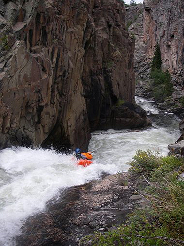
As you pick your way through you will eventually find yourself at the top of a beautiful, gorged in, thirty-five foot waterfall. This is the beginning of the Triple Set, which consists of three large waterfalls in a row.
Scout river left and look at the next two waterfalls downstream. This gorge is the highlight of the run, but must be scouted carefully. I'll let the photos do the explaining on this gorge, ENJOY!
The first drop in the Triple Set is this thirty-five foot waterfall.
Brady J running waterfall number one.
Locked in below the first drop in the Triple Set.
Brady and Austin scouting waterfall number two in the Triple Set.
Aaron Mulkey running the second waterfall in the Triple Set.
The third waterfall from high above, you can see the bottom of the second waterfall in this picture as well.
Aaron Mulkey running the third waterfall in the Triple Set.
The second and third drop in the Triple Set.
After the gorge paddle one half mile downstream to the limestone cliff and creek confluence and hike an hour and a half up the hill to your car. ENJOY!
Disclaimer: Follow the rules and make sure you get the proper permits before doing this run. The legality of kayaking on the North Fork of the Little Wind is controversial. This creek lies on Reservation land and access to these lands require you buying a fishing permit for the Wind River Indian Reservation for the amount of days you are on their land. Do not draw attention to yourselves, use Leave No Trace back country techniques and be kind to everyone you encounter, especially the locals. We are guests on their land, never forget that for a moment.
Please buy your permits and don't ruin the opportunity to kayak this run for everyone else. Also, please use caution when kayaking here. Do not draw attention to yourselves, use Leave No Trace back country techniques and be kind to everyone you encounter, especially the locals. We are guests on their land, never forget that for a moment.
P.S. the N.F.L.W. has more whitewater upstream of our put-in which can be accessed by doing an overnight trip from Twin Lakes. If you feel like a little adventure come out to Wyoming and be the first to paddle some whitewater that promises to be worth exploring! ( This will soon be done however, who will get there first? )
Put-in:
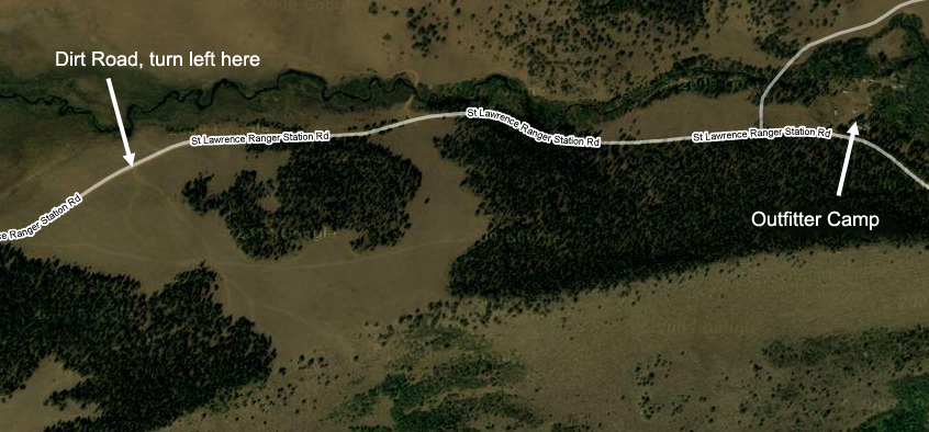
The Put-in for the N.F.L.W. is near the top of St. Lawrence Ranger Station road. ( recommend use of the Wyoming Gazetteer or obtaining a map of the Fort Washakie and St. Lawrence Quadrangles, to assist your trip.) Drive up the road about 16 miles until you pass a small outfitters camp on the right side of the road. The outfitter camp is noticeable by corrals, a tee-pee and trailers parked next to the road. After the camp drive roughly a half of a mile and look for a dirt road to your left. The road is completely unmaintained and simply goes left up a clearing and just out of sight of the road before ending at the overlook of the N.F.L.W.
If you reach the end of the St. Lawrence Ranger Station road then you've passed your put-in road and gone too far. From the top of the put-in road you will hike down the mountain to the river. (the route down is very simple to see from the overlook) Once to the river hike up stream less than a mile until you no longer see any beautiful California-esque slides. Start Kayaking Here.
Take-out:
The Takeout is reached off of St.Lawrence Ranger Station road as well. Roughly 14 to 15 miles up the Road you will reach the top of a very steep large hill ( the only large climb on the road). At the top of this climb you will drive a short distance until a small pull-out appears on the left-side of the road.
The Pull-out comes at the recession of a large hill to your left and provides a noticeable gap looking down into the canyons of the NFLW From the River you will paddle the four miles of whitewater and after the Three Amigos waterfall gorge, you will paddle a short stretch of boogie water until seeing an obvious limestone wall on river left. This spot is also recognizeable by the small creek flowing in from river left ( St.Lawrence Creek ). Hike up and out on the downstream side of the creek and above the limestone wall.
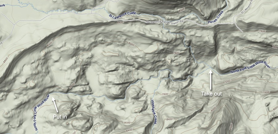
Put in and take out, courtesy of Google Maps.
The outfitters camp and the dirt road, courtesy of Google Maps.
My list of the best day runs in North America
1. Ravens Fork, North Carolina
2. Little White Salmon, Washington
3.
Toxaway River, North Carolina
4. Big Kimshew, California Sierras
5. Previously the creek occupying my number five spot was Rogers Creek and was followed by the Tatlow in B.C.,
but Rogers has been replaced with the NF Little Wind!
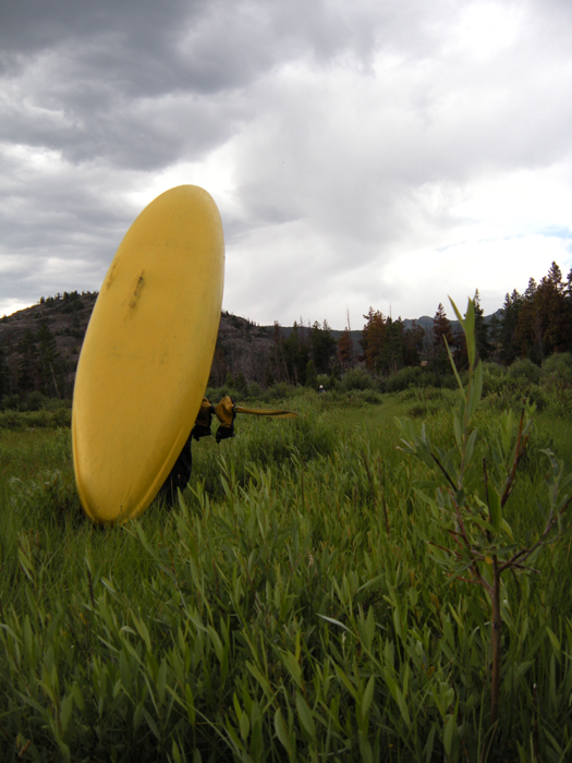
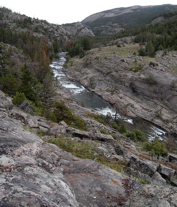
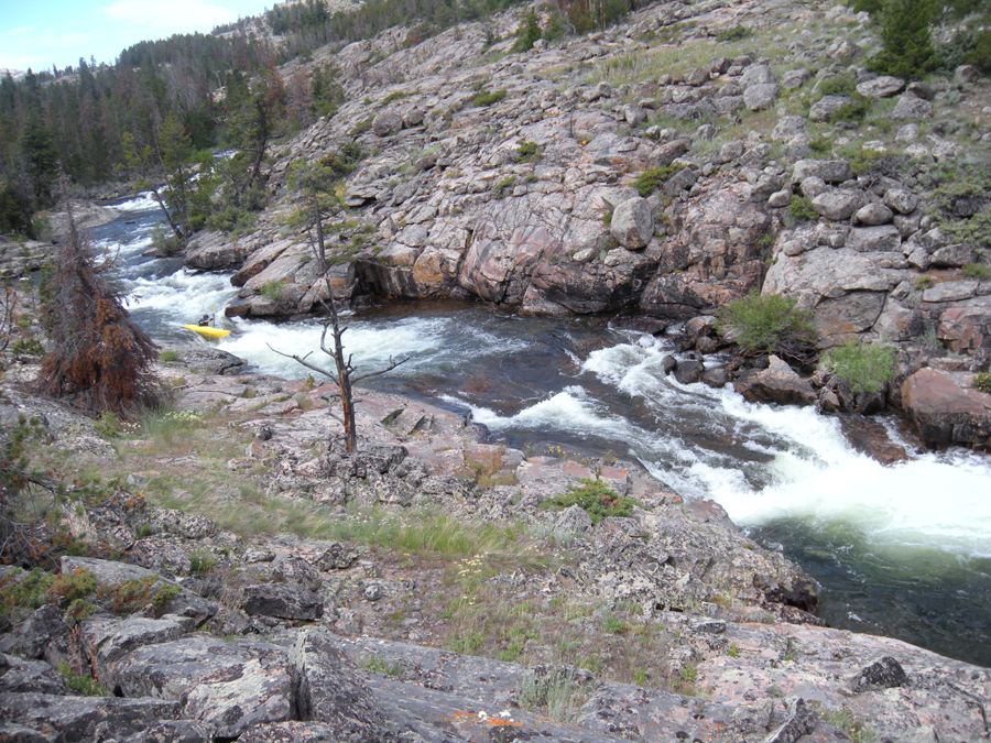
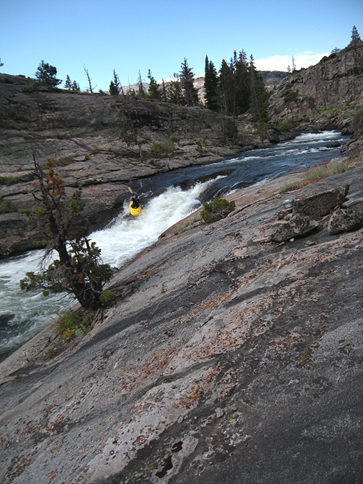
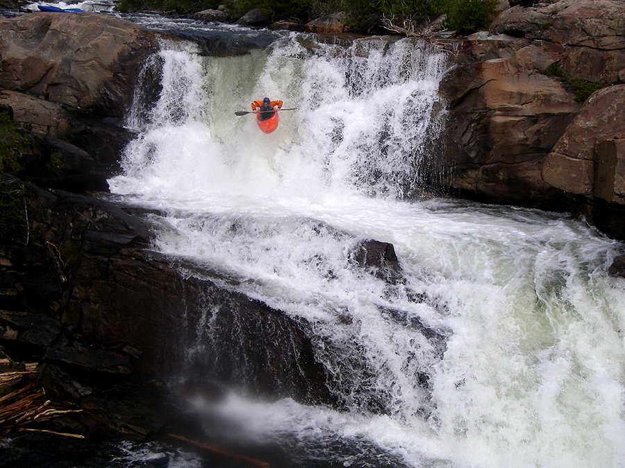
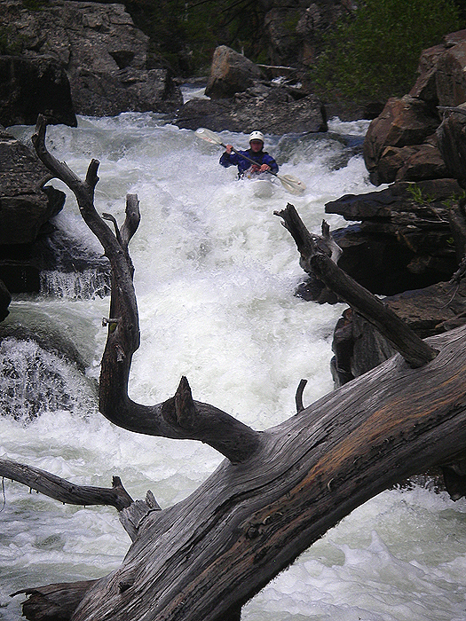
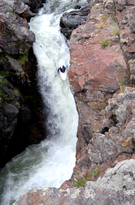
Photo by Evan Stafford
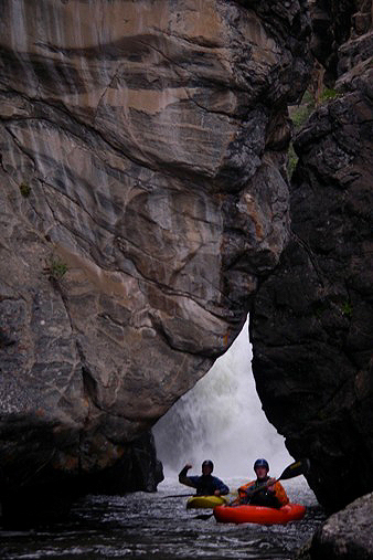
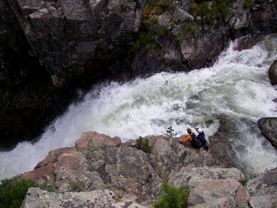
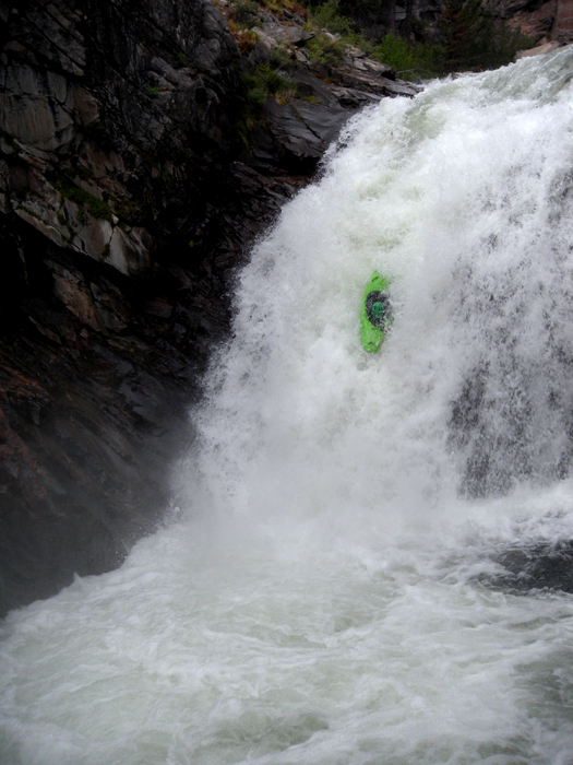
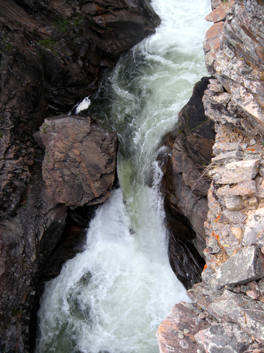
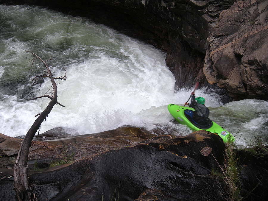
Photo by Evan Stafford