
We had been wondering about Jenny Creek for about two years. I first heard about this run from Dan Coyle, and then from Ben Stookesberry of Ashland Mine Productions. Ben (who has been shooting a lot of big-drop footage for their new video) said Jenny was a good run, and he gave me some critical beta on access that proved very helpful when we finally got down there.
Jenny begins in Oregon and ends in California, emptying into Iron Gate Reservoir on the California side. John had explored the drainage the previous year, so we had some basic idea of where to go. Once we hit Ashland we headed east and got to the bridge over Jenny after dark. We eagerly scrambled out and determined that there was about 200 cfs in the creek, which seemed like enough water for hardshell kayaks. We continued up to Copco road and camped for the night, planning on an early start to figure out the shuttle.
The following morning we got up and attempted to drive down Copco Road to Iron Gate Reservoir, which is the take-out. There were gates across the main gravel road, so we spent most of the morning driving around on poor-quality dirt roads, cutting and dragging logs out of the way, and generally wasting lots of time and energy trying to find a way around the gates. Finally we gave up and left my car at the end of one semi-passable road, planning to hike up from Iron Gate Reservoir once we were done. In retrospect this was a pretty bad idea, but we were fed up with driving and wanted to get on the creek. (A better plan would have been to drive back to Ashland access Iron Gate via I5, but we didn't want to drive that far.) So, with that in mind, we took a GPS reading on my car and drove back up to the put-in.
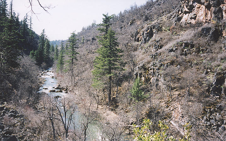
The put-in for this run is pretty easy to find, just follow the powerlines down to the creek. The path was very steep and involved a few rope-lowers to get down to the bottom of the canyon, but after about a half hour we were ready to go.
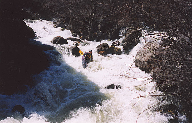
Of course, that changed pretty quickly. Soon the creek turned to the left and split around an island. I was leading and gave the signal to stop as I could see there was one heckuva big drop below us. "Looks like it drops at least 20 feet total." I said as I scrambled out of my boat.
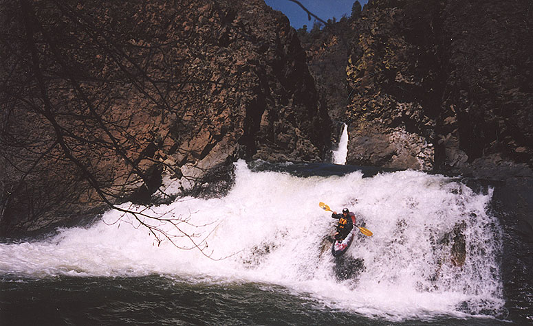
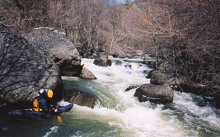
Sure enough, scouting revealed a large boulder garden that emptied into a vertical-walled gorge. Once below the drop we could see a monster horizon line just a few short drops downstream. I started to scout on the left wall, while Jesse ran the last few drops before the horizon line.

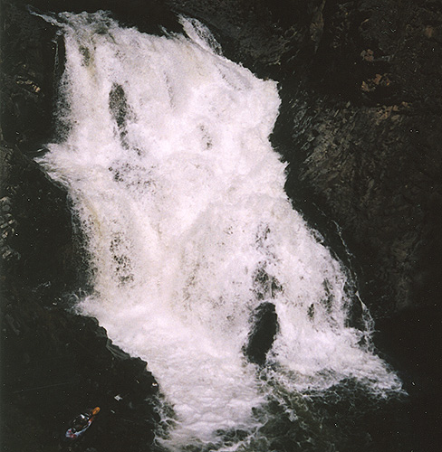
Jesse runs lower Jenny Creek Falls, (with a rail grab for style points) with the main falls in the background.
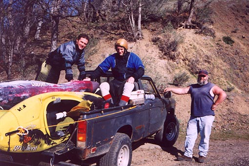
Soon I rounded the corner and saw a stocky, friendly looking guy fishing on the left side of the stream. He looked pretty surprised to see us, and I quickly struck up a conversation. Soon I got to the point and asked him if he would like to make forty bucks to haul us back up to our cars. Not surprisingly he grinned and said "Sure!".
This was a remarkable stroke of luck, and despite the fact that we were out a little cash we were VERY happy to pay it considering the options, all of which were pretty unpleasant..
The following day we hit California and did the Wilderness run on Deer Creek, Mill Creek, the Upper SF Trinity, Clear Creek Gorge, and the Scott River, all in a whirlwind eight day tour. I took a ton of photos, so more on those runs later...
Access and Flows: Jenny is a small desert creek which is entirely fed by snowmelt in the spring. It often runs in April and May on normal snow years, but there is no gauge. You might be able to infer the flows by monitoring the inflow to Iron Gate reservoir, but that's about it.
Access: Apparently Copco road (all gravel, but pretty good quality) used to be the ideal shuttle road, running parallel to Jenny all the way to Iron Gate. However, in 2000 or 2001 a shuttle driver ran over the landowners dog so now there is a gate exactly halfway down the road. This forces a mega-shuttle that would probably be about 1.5 hours one way, maybe a little less.
To get to the put-in: From Ashland, take highway 66 east 19 miles to the bridge over Jenny Creek. This spot is impossible to miss because the Pinehurst inn is right next to the bridge. Cross Jenny Creek and continue uphill about .25 miles until you come to Copco Road on the right. Turn here and drive about eight miles to the gate across the road. Veer right and continue on the main road until you see the powerlines. Once you reach the powerlines, follow them down a secondary road to the top of Jenny Creek Gorge. THERE IS NO WAY through to Iron Gate reservoir from here on the other dirt roads that seem to run off in every direction; we wasted most of the day trying to get through, to no avail. Don't make the same mistake!
To get to the take out: Take Highway 66 back to south Ashland and head south on I5 twenty miles until you get to the Hornbrook exit. Head east on Hornbrook-Ager road for 15 miles (Hornbrook- Ager becomes Copco Road) staying on the north side of Iron Gate Reservoir until the road crosses the reservoir. Jenny Creek comes in here, so leave your car near the bridge.